Cof Cymru: National Historic Assets of Wales · Wales
Lime Kiln on bank above Grove Caravan Park
Pendine, Carmarthenshire, Wales
A Grade II listed building in Green Bridge, Carmarthen, Pendine, Carmarthenshire, designated on 4 December 2000.
The record
- Designation
- Listed building, Grade II
- Broad class
- Industrial
- Date of designation
- 4 December 2000
- Locality
- Green Bridge
- Town
- Carmarthen
- Community
- Pendine
- Unitary authority
- Carmarthenshire
- Country
- Wales
- Coordinates
- 51.74994, -4.57315
- Cadw reference
- 24448
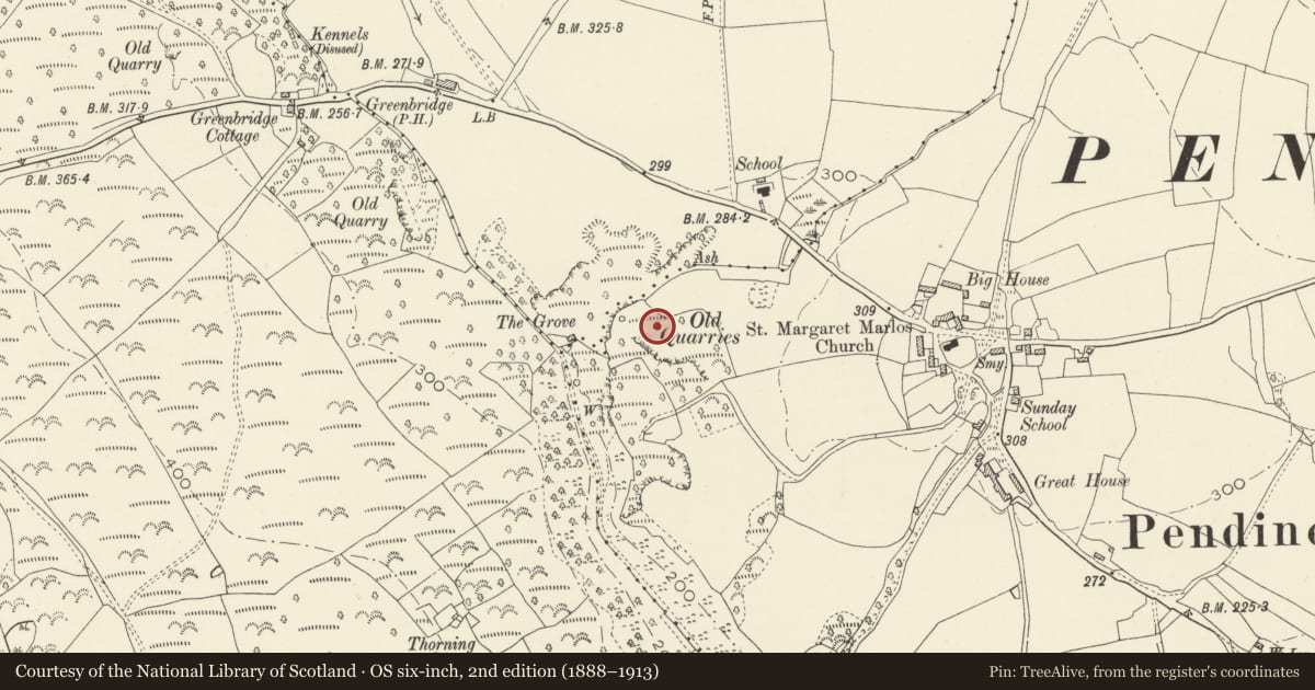
Slide toward Today to fade the historical sheet and see the modern map underneath.
David Rumsey Map Collection, Stanford LibrariesDavid Rumsey Map Collection, Stanford LibrariesDavid Rumsey Map Collection, Stanford LibrariesDavid Rumsey Map Collection, Stanford LibrariesDavid Rumsey Map Collection, Stanford Libraries
5 historical maps cover this location, the earliest the 1636 map "Cornubia : Devonia, Somersetus, Dorcestria, Wiltonia, Glocestria ..." (David Rumsey Map Collection, Stanford Libraries).
Historical maps covering this location
- 1636 · Cornubia : Devonia, Somersetus, Dorcestria, Wiltonia, Glocestria ... (David Rumsey Map Collection, Stanford Libraries)
- 1637 · The fourth table of England. Cornub. Devonia, Somerset etc. (David Rumsey Map Collection, Stanford Libraries)
- 1830 · V.3:11-15:XV. Britisches Reich. A. Kon: England. b. Frstenthum Wales: Shire: 37-40 (David Rumsey Map Collection, Stanford Libraries)
- 1891 · Sheet 10. Ordnance Survey of England and Wales. . (David Rumsey Map Collection, Stanford Libraries)
- 1898 · 229 Carmarthen (Hills) (David Rumsey Map Collection, Stanford Libraries)
Cadw's description
Location
Situated in a wood above and to the E of Grove Caravan Park. There are two lime kilns in the wood and this is the one to the E.
History
Mid C19 lime-kiln, one of two in the woodland, associated with nearby limestone quarrying.
Exterior
Lime kiln, rubble stone, large scale, roughly square in plan, some 5m high, built into bank. Two kiln eyes, one roughly keel shaped with stones stepped to steep triangular head, the other with a lower broad opening with cut stone voussoirs and keystone. Crucible filled in.
Reason for designation
Included as a well-preserved large quarry limekiln, indicative of the importance of the industry to Marros Mountain and environs.
Nearby in the register
- Church of St Margaret of AntiochReligious, Ritual and Funeraryunder 1 mi
- Outside Kitchen at the Great HouseDomesticunder 1 mi
- Front garden walls and gatepiers at the Great HouseDomesticunder 1 mi
- The Great House and attached outbuildingsDomesticunder 1 mi
Other entries of the same register within about three miles of this one, by straight line.