Cof Cymru: National Historic Assets of Wales · Wales
Outside Kitchen at the Great House
Pendine, Carmarthenshire, Wales
A Grade II listed building in Pendine, Carmarthen, Carmarthenshire, designated on 4 December 2000.
The record
- Designation
- Listed building, Grade II
- Broad class
- Domestic
- Date of designation
- 4 December 2000
- Locality
- Pendine
- Town
- Carmarthen
- Community
- Pendine
- Unitary authority
- Carmarthenshire
- Country
- Wales
- Coordinates
- 51.74826, -4.56682
- Cadw reference
- 24447
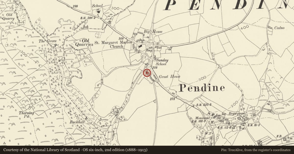
Slide toward Today to fade the historical sheet and see the modern map underneath.
David Rumsey Map Collection, Stanford LibrariesDavid Rumsey Map Collection, Stanford LibrariesDavid Rumsey Map Collection, Stanford LibrariesDavid Rumsey Map Collection, Stanford LibrariesDavid Rumsey Map Collection, Stanford Libraries
5 historical maps cover this location, the earliest the 1636 map "Cornubia : Devonia, Somersetus, Dorcestria, Wiltonia, Glocestria ..." (David Rumsey Map Collection, Stanford Libraries).
Historical maps covering this location
- 1636 · Cornubia : Devonia, Somersetus, Dorcestria, Wiltonia, Glocestria ... (David Rumsey Map Collection, Stanford Libraries)
- 1637 · The fourth table of England. Cornub. Devonia, Somerset etc. (David Rumsey Map Collection, Stanford Libraries)
- 1830 · V.3:11-15:XV. Britisches Reich. A. Kon: England. b. Frstenthum Wales: Shire: 37-40 (David Rumsey Map Collection, Stanford Libraries)
- 1891 · Sheet 10. Ordnance Survey of England and Wales. . (David Rumsey Map Collection, Stanford Libraries)
- 1898 · 229 Carmarthen (Hills) (David Rumsey Map Collection, Stanford Libraries)
Cadw's description
Location
Situated just to the N of Great House. The house is some 200m S of the junction of the B4314 and a minor road to Marros.
History
Outside kitchen possibly C18 or early C19, to Great House.
Exterior
Outside kitchen, whitewashed rubble stone single storey building, broad across gable, with left end large stone stack and sheet metal roof cladding. Plank door to centre and window to right. Right gable end wall has blocked opening.
Reason for designation
Included as a well-preserved small outside kitchen once typical of the region but now rare and for group value with the Great House.
Nearby in the register
- Front garden walls and gatepiers at the Great HouseDomesticunder 1 mi
- The Great House and attached outbuildingsDomesticunder 1 mi
- Church of St Margaret of AntiochReligious, Ritual and Funeraryunder 1 mi
- Lime Kiln on bank above Grove Caravan ParkIndustrialunder 1 mi
Other entries of the same register within about three miles of this one, by straight line.