Cof Cymru: National Historic Assets of Wales · Wales
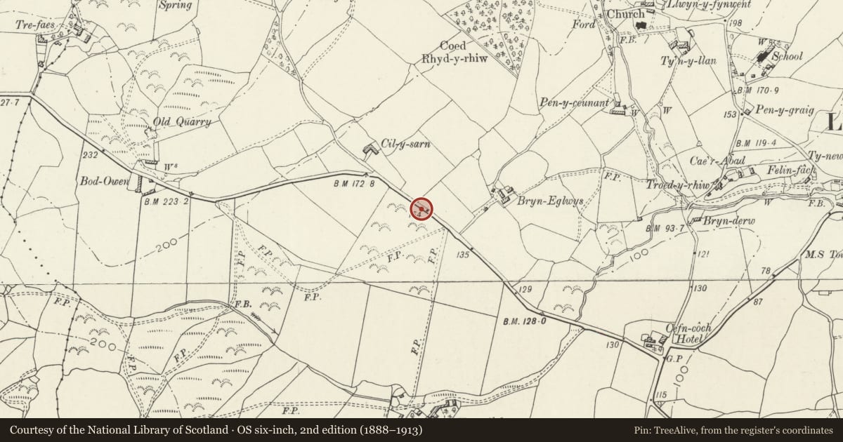
Mile Marker opposite Bryn Eglwys
Llanegryn, Gwynedd, Wales
A Grade II listed building in Llanegryn, Gwynedd, designated on 26 July 2000.
The record
- Designation
- Listed building, Grade II
- Broad class
- Transport
- Date of designation
- 26 July 2000
- Locality
- Llanegryn
- Community
- Llanegryn
- Unitary authority
- Gwynedd
- Country
- Wales
- Coordinates
- 52.62820, -4.08249
- Cadw reference
- 23783
Slide toward Today to fade the historical sheet and see the modern map underneath.
David Rumsey Map Collection, Stanford LibrariesDavid Rumsey Map Collection, Stanford LibrariesDavid Rumsey Map Collection, Stanford LibrariesDavid Rumsey Map Collection, Stanford LibrariesLlyfrgell Genedlaethol Cymru – The National Library of Wales
5 historical maps cover this location, the earliest the 1795 map "To Sir Watkin Williams-Wynn Bart ... the map of the six counties of North Wales is most humbly inscribed by his obedient humble servant" (Llyfrgell Genedlaethol Cymru – The National Library of Wales).
Historical maps covering this location
- 1795 · To Sir Watkin Williams-Wynn Bart ... the map of the six counties of North Wales is most… (Llyfrgell Genedlaethol Cymru – The National Library of Wales)
- 1883 · Watershed map England, Wales 3. (David Rumsey Map Collection, Stanford Libraries)
- 1896 · Sheet 7. Ordnance Survey of England and Wales. (David Rumsey Map Collection, Stanford Libraries)
- 1899 · 149 Barmouth (Hills) (David Rumsey Map Collection, Stanford Libraries)
- 1901 · Sheet 9 and 10. (David Rumsey Map Collection, Stanford Libraries)
Cadw's description
Location
The mile marker is on the main road from Tywyn to Dolgellau, nearly opposite the farm road to Bryn Eglwys. It is set in a bank on the verge of the road, SE of the corner at Cil-y-sarn.
History
The road was placed under the Tywyn to Dolgellau Turnpike Trust following the Act of 1838, which licensed the erection of tollbooths. The iron mile markers along the route were probably erected shortly after.
Exterior
Made of cast iron. An open backed triangular stem rising to an enlarged triangular head, the top sloping back to splayed top corners. Raised lettering reading, on the left, DOLGELLEY / 15, and on the right, TOWYN / 4. The stem is now partly buried.
Reason for designation
Included as one of a series of mile markers along the coastal route N of Bryn Crug, recalling the earlier administrative arrangements for the county roads.
Nearby in the register
- Church of St Mary and St EgrynReligious, Ritual and Funeraryunder 1 mi
- Waen Fach Standing StoneStanding Stoneunder 1 mi
- Lychgate at the Church of St Mary and St EgrynReligious, Ritual and Funeraryunder 1 mi
- Cow house in farmyard at TrefaesNo class recordedunder 1 mi
Other entries of the same register within about three miles of this one, by straight line.