Cof Cymru: National Historic Assets of Wales · Wales
Cock Pit at Peniarth Uchaf
Llanegryn, Gwynedd, Wales
A Grade II listed building in Llanegryn, Gwynedd, designated on 26 July 2000.
The record
- Designation
- Listed building, Grade II
- Broad class
- Gardens, Parks and Urban Spaces
- Date of designation
- 26 July 2000
- Locality
- Llanegryn
- Community
- Llanegryn
- Unitary authority
- Gwynedd
- Country
- Wales
- Coordinates
- 52.64677, -4.02097
- Cadw reference
- 23782
Slide toward Today to fade the historical sheet and see the modern map underneath.
David Rumsey Map Collection, Stanford LibrariesDavid Rumsey Map Collection, Stanford LibrariesDavid Rumsey Map Collection, Stanford LibrariesLlyfrgell Genedlaethol Cymru – The National Library of WalesDavid Rumsey Map Collection, Stanford Libraries
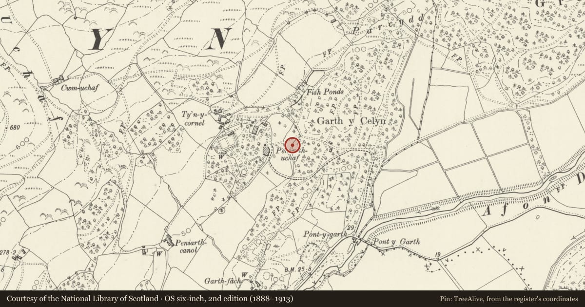
5 historical maps cover this location, the earliest the 1795 map "To Sir Watkin Williams-Wynn Bart ... the map of the six counties of North Wales is most humbly inscribed by his obedient humble servant" (Llyfrgell Genedlaethol Cymru – The National Library of Wales).
Historical maps covering this location
- 1795 · To Sir Watkin Williams-Wynn Bart ... the map of the six counties of North Wales is most… (Llyfrgell Genedlaethol Cymru – The National Library of Wales)
- 1883 · Watershed map England, Wales 3. (David Rumsey Map Collection, Stanford Libraries)
- 1896 · Sheet 7. Ordnance Survey of England and Wales. (David Rumsey Map Collection, Stanford Libraries)
- 1899 · 149 Barmouth (Hills) (David Rumsey Map Collection, Stanford Libraries)
- 1901 · Sheet 9 and 10. (David Rumsey Map Collection, Stanford Libraries)
Cadw's description
Location
The cock pit is set on a natural rocky outcrop, opposite the front elevation of Peniarth-uchaf.
History
Built probably in the C18 or early C19 before cock-fighting was banned in Britain in 1849.
Exterior
The cockpit is circular on plan and c3m in diameter, constructed of local stone rubble forming walls c1.2m high capped by inward sloping copings forming a drip internally. Cut into the copings are rectangular emplacements for timber posts, presumably to support a covering roof, now lost. A gap in the wall at the NE side provides an entrance, with a step down into the ring.
Reason for designation
Included, notwithstanding its present poor condition, as an example of a rare class of building of special interest for its relationship to the house.
Nearby in the register
- Game Larder at Peniarth UchafGardens, Parks and Urban Spacesunder 1 mi
- Peniarth UchafDomesticunder 1 mi
- Coach-house and Stables at Peniarth UchafGardens, Parks and Urban Spacesunder 1 mi
- Carthouse range at Ty'n y CornelAgriculture and Subsistenceunder 1 mi
Other entries of the same register within about three miles of this one, by straight line.