Cof Cymru: National Historic Assets of Wales · Wales
Game Larder at Peniarth Uchaf
Llanegryn, Gwynedd, Wales
A Grade II listed building in Llanegryn, Gwynedd, designated on 26 July 2000.
The record
- Designation
- Listed building, Grade II
- Broad class
- Gardens, Parks and Urban Spaces
- Date of designation
- 26 July 2000
- Locality
- Llanegryn
- Community
- Llanegryn
- Unitary authority
- Gwynedd
- Country
- Wales
- Coordinates
- 52.64693, -4.02196
- Cadw reference
- 23781
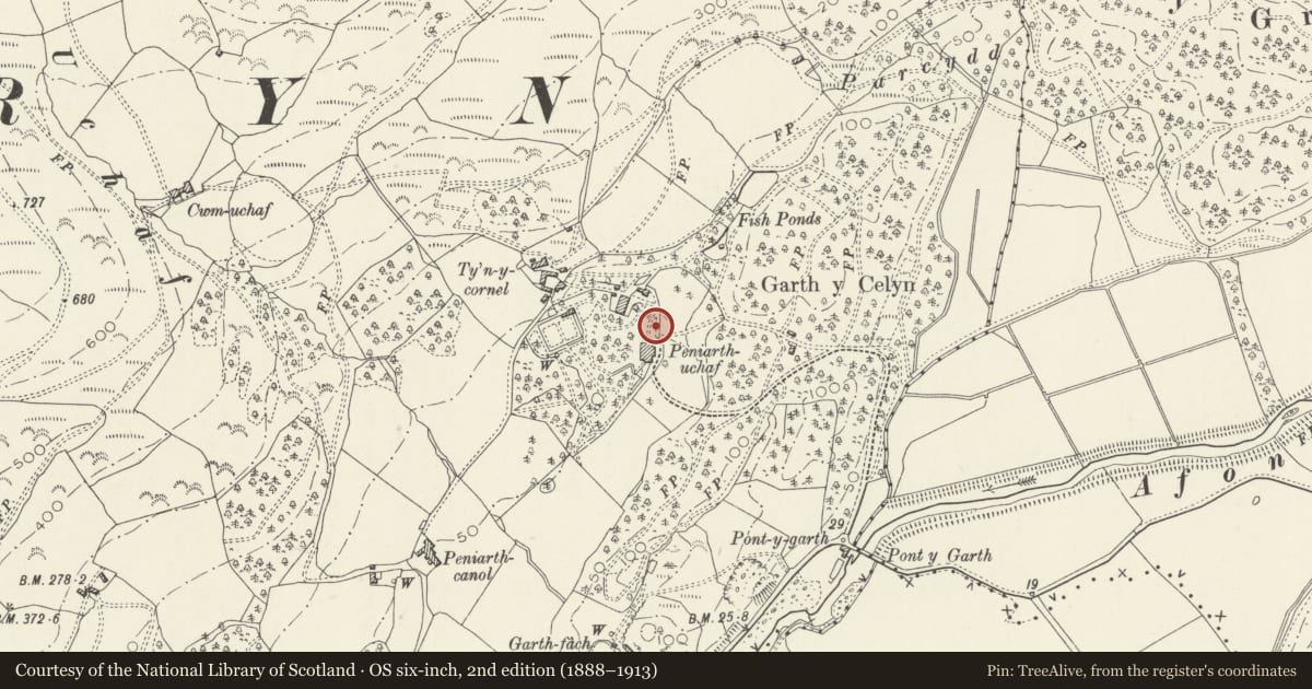
Slide toward Today to fade the historical sheet and see the modern map underneath.
David Rumsey Map Collection, Stanford LibrariesDavid Rumsey Map Collection, Stanford LibrariesDavid Rumsey Map Collection, Stanford LibrariesLlyfrgell Genedlaethol Cymru – The National Library of WalesDavid Rumsey Map Collection, Stanford Libraries
5 historical maps cover this location, the earliest the 1795 map "To Sir Watkin Williams-Wynn Bart ... the map of the six counties of North Wales is most humbly inscribed by his obedient humble servant" (Llyfrgell Genedlaethol Cymru – The National Library of Wales).
Historical maps covering this location
- 1795 · To Sir Watkin Williams-Wynn Bart ... the map of the six counties of North Wales is most… (Llyfrgell Genedlaethol Cymru – The National Library of Wales)
- 1883 · Watershed map England, Wales 3. (David Rumsey Map Collection, Stanford Libraries)
- 1896 · Sheet 7. Ordnance Survey of England and Wales. (David Rumsey Map Collection, Stanford Libraries)
- 1899 · 149 Barmouth (Hills) (David Rumsey Map Collection, Stanford Libraries)
- 1901 · Sheet 9 and 10. (David Rumsey Map Collection, Stanford Libraries)
Cadw's description
Location
The game larder stands to the N of the house, near the farm road to Ty'n-y-cornel.
History
The game larder was probably built in the early-mid C19.
Exterior
A small octagonal structure built with stone rubble walls 1.3m high, capped with slate sills from which timber posts rise to support the octagonal slated roof. The openings between the posts were originally filled with zinc gauze, which still lines the soffit of the roof. Central batten to each opening with close spaced hooks presumably on which to hang game. Wide eaves supported by shaped timber brackets. At the centre a metal ventilator pipe rises through the roof, also protected with gauze, to terminate with a wire balloon, now missing. The entrance is on the N side, the door now missing.
Interior
Quarry tile floor internally, and the walls are rendered up to the sills.
Reason for designation
Including as an interesting and unusual small structure, an important adjunct to a gentleman's estate in the C19.
Nearby in the register
- Peniarth UchafDomesticunder 1 mi
- Coach-house and Stables at Peniarth UchafGardens, Parks and Urban Spacesunder 1 mi
- Cock Pit at Peniarth UchafGardens, Parks and Urban Spacesunder 1 mi
- Carthouse range at Ty'n y CornelAgriculture and Subsistenceunder 1 mi
Other entries of the same register within about three miles of this one, by straight line.