Cof Cymru: National Historic Assets of Wales · Wales
Cowhouse at Eithinog-uchaf
Llanllyfni, Gwynedd, Wales
A Grade II listed building in Penygroes, Llanllyfni, Gwynedd, designated on 21 July 2000.
The record
- Designation
- Listed building, Grade II
- Broad class
- Agriculture and Subsistence
- Date of designation
- 21 July 2000
- Locality
- Penygroes
- Community
- Llanllyfni
- Unitary authority
- Gwynedd
- Country
- Wales
- Coordinates
- 53.05274, -4.30721
- Cadw reference
- 23753
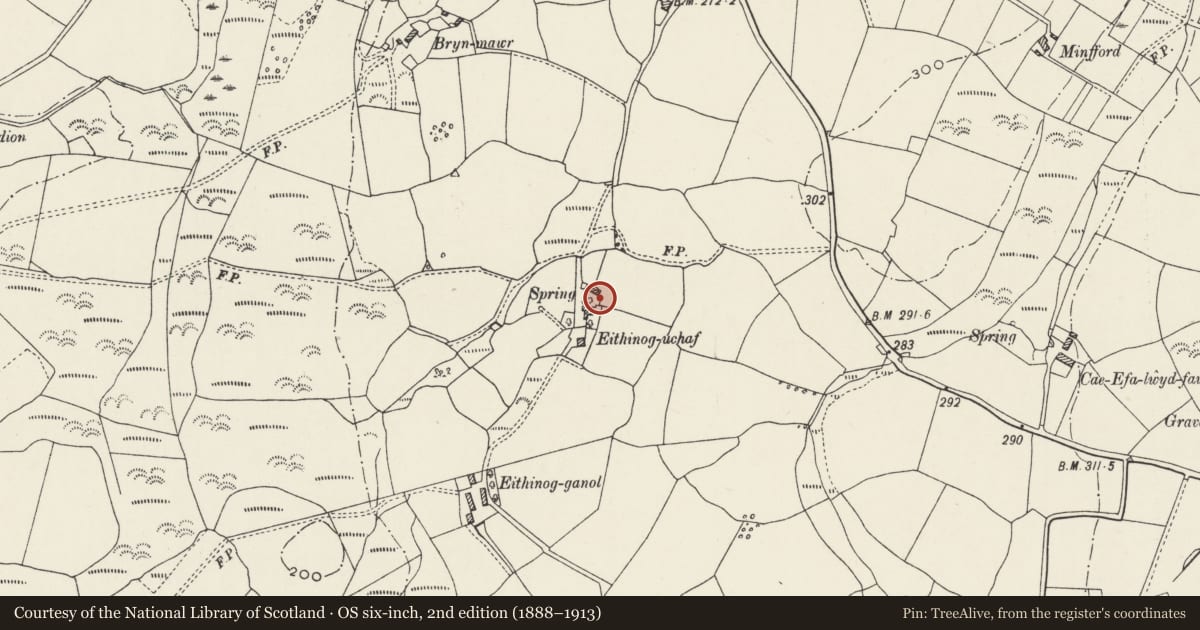
Slide toward Today to fade the historical sheet and see the modern map underneath.
David Rumsey Map Collection, Stanford LibrariesDavid Rumsey Map Collection, Stanford LibrariesDavid Rumsey Map Collection, Stanford LibrariesDavid Rumsey Map Collection, Stanford LibrariesLlyfrgell Genedlaethol Cymru – The National Library of Wales
5 historical maps cover this location, the earliest the 1795 map "To Sir Watkin Williams-Wynn Bart ... the map of the six counties of North Wales is most humbly inscribed by his obedient humble servant" (Llyfrgell Genedlaethol Cymru – The National Library of Wales).
Historical maps covering this location
- 1795 · To Sir Watkin Williams-Wynn Bart ... the map of the six counties of North Wales is most… (Llyfrgell Genedlaethol Cymru – The National Library of Wales)
- 1883 · Watershed map England, Wales 3. (David Rumsey Map Collection, Stanford Libraries)
- 1896 · Sheet 7. Ordnance Survey of England and Wales. (David Rumsey Map Collection, Stanford Libraries)
- 1899 · 118 Nevin (Hills) (David Rumsey Map Collection, Stanford Libraries)
- 1901 · Sheet 9 and 10. (David Rumsey Map Collection, Stanford Libraries)
Cadw's description
Location
Located on the east side of the farmyard at Eithinog-uchaf; the farmyard sits to the north of the farmhouse on the track to Pant Eithinog, which itself lies just off Ffordd Clynnog.
History
Shown on the 1840 Tithe Map, the cowhouse was probably built c1825, which is the date of an overmantel in the farmhouse and appears to be contemporary with the construction of the farmhouse.
Exterior
Long, low single-storey building of uncoursed rubblestone with slate roof. Front elevation onto yard has 2 small multi-paned/ventilated windows with stone lintels on left; stable doors and small rooflights to right.
Interior
Interior not inspected at time of Survey.
Reason for designation
Included as a well-preserved early C19 cowhouse having strong group value with the other buildings at Eithinog-uchaf.
Nearby in the register
- Cowhouse/granary and pigsties at Eithinog-uchafAgriculture and Subsistenceunder 1 mi
- Barn and stables at Eithinog-uchafAgriculture and Subsistenceunder 1 mi
- Former cottage at Eithinog-uchafDomesticunder 1 mi
- Eithinog-uchafDomesticunder 1 mi
Other entries of the same register within about three miles of this one, by straight line.