Cof Cymru: National Historic Assets of Wales · Wales
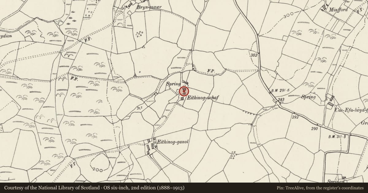
Former cottage at Eithinog-uchaf
Llanllyfni, Gwynedd, Wales
A Grade II listed building in Penygroes, Llanllyfni, Gwynedd, designated on 21 July 2000.
The record
- Designation
- Listed building, Grade II
- Broad class
- Domestic
- Date of designation
- 21 July 2000
- Locality
- Penygroes
- Community
- Llanllyfni
- Unitary authority
- Gwynedd
- Country
- Wales
- Coordinates
- 53.05249, -4.30750
- Cadw reference
- 23743
Slide toward Today to fade the historical sheet and see the modern map underneath.
David Rumsey Map Collection, Stanford LibrariesDavid Rumsey Map Collection, Stanford LibrariesDavid Rumsey Map Collection, Stanford LibrariesDavid Rumsey Map Collection, Stanford LibrariesLlyfrgell Genedlaethol Cymru – The National Library of Wales
5 historical maps cover this location, the earliest the 1795 map "To Sir Watkin Williams-Wynn Bart ... the map of the six counties of North Wales is most humbly inscribed by his obedient humble servant" (Llyfrgell Genedlaethol Cymru – The National Library of Wales).
Historical maps covering this location
- 1795 · To Sir Watkin Williams-Wynn Bart ... the map of the six counties of North Wales is most… (Llyfrgell Genedlaethol Cymru – The National Library of Wales)
- 1883 · Watershed map England, Wales 3. (David Rumsey Map Collection, Stanford Libraries)
- 1896 · Sheet 7. Ordnance Survey of England and Wales. (David Rumsey Map Collection, Stanford Libraries)
- 1899 · 118 Nevin (Hills) (David Rumsey Map Collection, Stanford Libraries)
- 1901 · Sheet 9 and 10. (David Rumsey Map Collection, Stanford Libraries)
Cadw's description
Location
Situated between the farmhouse at Eithinog-uchaf and its farmyard to the north.
History
Not shown on the 1840 Tithe Map, the cottage was probably built shortly after this date as accommodation for farmhands; it is now used for storage.
Exterior
Rectangular plan aligned north-south. Roughly coursed rubblestone; slate roof. Front elevation has fixed-light windows with slate cills on either side of central boarded door; integral end stack to right.
Interior
2 A-frame trusses, slate floor and slate slab partition to left of door; chimney breast to right gable end has purplish brown brick jambs and slate lintel to fireplace; position of copper to right.
Reason for designation
Included as a well-preserved mid-C19 farmhands' cottage, which has strong group value with the farmhouse and farmbuildings at Eithinog-uchaf.
Nearby in the register
- Cowhouse/granary and pigsties at Eithinog-uchafAgriculture and Subsistenceunder 1 mi
- Eithinog-uchafDomesticunder 1 mi
- Cowhouse at Eithinog-uchafAgriculture and Subsistenceunder 1 mi
- Barn and stables at Eithinog-uchafAgriculture and Subsistenceunder 1 mi
Other entries of the same register within about three miles of this one, by straight line.