Cof Cymru: National Historic Assets of Wales · Wales
Outlying tower designed to complement Penrice Towers
Ilston, Swansea, Wales
A Grade II* listed building in Penrice, Swansea, Ilston, designated on 19 July 2000.
The record
- Designation
- Listed building, Grade II*
- Broad class
- Domestic
- Date of designation
- 19 July 2000
- Locality
- Penrice
- Town
- Swansea
- Community
- Ilston
- Unitary authority
- Swansea
- Country
- Wales
- Coordinates
- 51.57413, -4.16316
- Cadw reference
- 23550
Slide toward Today to fade the historical sheet and see the modern map underneath.
David Rumsey Map Collection, Stanford LibrariesDavid Rumsey Map Collection, Stanford LibrariesDavid Rumsey Map Collection, Stanford LibrariesDavid Rumsey Map Collection, Stanford LibrariesDavid Rumsey Map Collection, Stanford Libraries
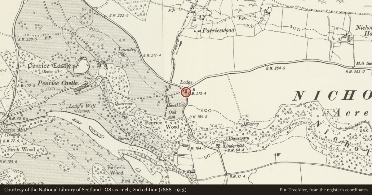
5 historical maps cover this location, the earliest the 1636 map "Cornubia : Devonia, Somersetus, Dorcestria, Wiltonia, Glocestria ..." (David Rumsey Map Collection, Stanford Libraries).
Historical maps covering this location
- 1636 · Cornubia : Devonia, Somersetus, Dorcestria, Wiltonia, Glocestria ... (David Rumsey Map Collection, Stanford Libraries)
- 1637 · The fourth table of England. Cornub. Devonia, Somerset etc. (David Rumsey Map Collection, Stanford Libraries)
- 1865 · England and Wales. England No. 6. (David Rumsey Map Collection, Stanford Libraries)
- 1891 · Sheet 10. Ordnance Survey of England and Wales. . (David Rumsey Map Collection, Stanford Libraries)
- 1920 · Sheet 100. Llanelly. (David Rumsey Map Collection, Stanford Libraries)
Cadw's description
Location
To the south east of the main gates to Penrice park, built into the park boundary wall.
History
A detached item of military folly architecture dating probably from c1790, designed as a balance to the gatelodge known as Penrice Towers to give visitors to Penrice the illusion of passing through a romantic ruined castle on their entrance to the park.
Exterior
The outlying tower to the south of the gates is in similar masonry to that of Penrice Towers, with window-like openings in the masonry to front and to rear and a door-like opening to the rear.
Reason for designation
Listed at II* for group value as an integral, albeit detached, part of the design of a grade II* listed monument, Penrice Towers.
Nearby in the register
- Penrice Castle North-East Gates, Railings and PiersDomesticunder 1 mi
- Penrice Towers gate houseDomesticunder 1 mi
- The OrangeryDomesticunder 1 mi
- Old Cottage in grounds of Underhill CottageDomesticunder 1 mi
Other entries of the same register within about three miles of this one, by straight line.