Cof Cymru: National Historic Assets of Wales · Wales
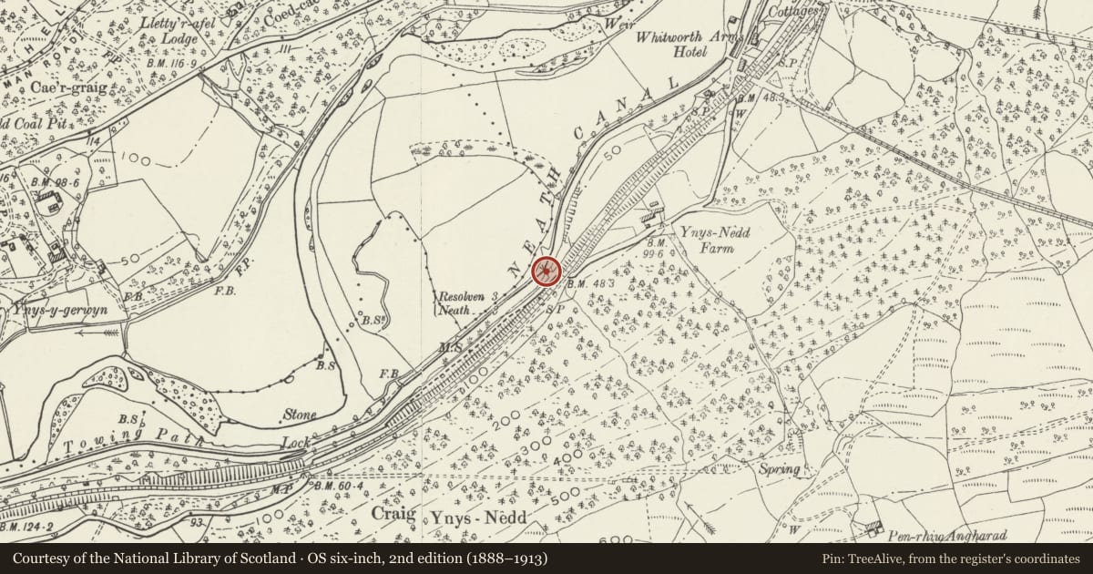
Bridge over Neath Canal SW of Ynys Nedd Farm
Tonna, Neath Port Talbot, Wales
A Grade II listed building in Ynys Nedd Farm, Tonna, Neath Port Talbot, designated on 25 February 2000.
The record
- Designation
- Listed building, Grade II
- Broad class
- Transport
- Date of designation
- 25 February 2000
- Locality
- Ynys Nedd Farm
- Town
- Tonna
- Community
- Tonna
- Unitary authority
- Neath Port Talbot
- Country
- Wales
- Coordinates
- 51.68470, -3.74437
- Cadw reference
- 22873
Slide toward Today to fade the historical sheet and see the modern map underneath.
David Rumsey Map Collection, Stanford LibrariesDavid Rumsey Map Collection, Stanford LibrariesDavid Rumsey Map Collection, Stanford LibrariesDavid Rumsey Map Collection, Stanford LibrariesDavid Rumsey Map Collection, Stanford Libraries
5 historical maps cover this location, the earliest the 1608 map "(13) Cambriae Typus." (David Rumsey Map Collection, Stanford Libraries).
Historical maps covering this location
- 1608 · (13) Cambriae Typus. (David Rumsey Map Collection, Stanford Libraries)
- 1636 · Cornubia : Devonia, Somersetus, Dorcestria, Wiltonia, Glocestria ... (David Rumsey Map Collection, Stanford Libraries)
- 1637 · The fourth table of England. Cornub. Devonia, Somerset etc. (David Rumsey Map Collection, Stanford Libraries)
- 1830 · V.3:11-15:XV. Britisches Reich. A. Kon: England. b. Frstenthum Wales: Shire: 37-40 (David Rumsey Map Collection, Stanford Libraries)
- 1865 · England and Wales. England No. 6. (David Rumsey Map Collection, Stanford Libraries)
Cadw's description
Location
Approximately 2.2km ENE of Tonna church and on a farm track SW of Ynys Nedd Farm.
History
The Neath Canal was begun in 1791 and opened in 1794. Traffic ceased in 1921. The bridge is probably an original feature of the canal and was built to provide access to the land around Ynys Nedd Farm.
Exterior
A single-span bridge of coursed rubble and segmental arch with dressed voussoirs. The abutments and parapet curve out the ends. The parapet on E side has replaced cement copings. The parapet on W side (partly collapsed at the time of inspection) is replaced with concrete walls flanking a steel rail. The surface of the deck is replaced with a hardcore of stones and is ramped at N end.
Reason for designation
Listed for its industrial archaeological interest as a built feature of the Neath Canal and for group value with other canal structures.
Nearby in the register
- Twrch Brook culvert and overflow sluice on the Neath CanalTransportunder 1 mi
- Milestone on B4242, 100m east of Rock & Fountain PHTransportunder 1 mi
- Pen-Rhiw-Angharad Round CairnsCairnfieldunder 1 mi
- Blaen-Cwmbach EarthworkEnclosureunder 1 mi
Other entries of the same register within about three miles of this one, by straight line.