Cof Cymru: National Historic Assets of Wales · Wales
Hodge House
Castle, Cardiff, Wales
A Grade II listed building in Castle, Cardiff, designated on 30 April 1999.
The record
- Designation
- Listed building, Grade II
- Broad class
- Commercial
- Date of designation
- 30 April 1999
- Community
- Castle
- Unitary authority
- Cardiff
- Country
- Wales
- Coordinates
- 51.47967, -3.17971
- Cadw reference
- 21667
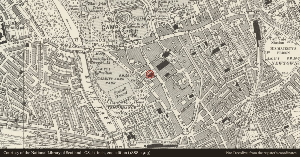
Slide toward Today to fade the historical sheet and see the modern map underneath.
David Rumsey Map Collection, Stanford LibrariesDavid Rumsey Map Collection, Stanford LibrariesDavid Rumsey Map Collection, Stanford LibrariesDavid Rumsey Map Collection, Stanford LibrariesDavid Rumsey Map Collection, Stanford Libraries
5 historical maps cover this location, the earliest the 1636 map "Cornubia : Devonia, Somersetus, Dorcestria, Wiltonia, Glocestria ..." (David Rumsey Map Collection, Stanford Libraries).
Historical maps covering this location
- 1636 · Cornubia : Devonia, Somersetus, Dorcestria, Wiltonia, Glocestria ... (David Rumsey Map Collection, Stanford Libraries)
- 1865 · England and Wales. England No. 6. (David Rumsey Map Collection, Stanford Libraries)
- 1895 · Sheet 11. Ordnance Survey of England and Wales. (David Rumsey Map Collection, Stanford Libraries)
- 1898 · 263 Cardiff (Hills) (David Rumsey Map Collection, Stanford Libraries)
- 1913 · Sheet 110. Cardiff & Mouth of the Severn. (David Rumsey Map Collection, Stanford Libraries)
Cadw's description
Location
On corner with Guildhall Place.
History
Built 1915 on site of Cardiff's Victorian town hall. Built for Co-operative Wholesale Society in a style derived from Edwardian buildings in Regent Street, London.
Exterior
Large Portland Stone faced commercial building in classicising style with French Details. Enriched with cartouches, garlands, relief window aprons etc. Six storeys including attic; square clock tower; on grey plinth of Forest of Dean stone.
St Mary Street frontage of 11 bays. Seven bays of tripartite "Chicago" windows, but paired windows to advanced 2nd and 10th bays, and single windows to narrow end bays. Balustraded parapet, central window, stepped up. Top storey has cornices over windows. Central bay advanced with open pediment, entrance portal (grey stone) with in antis treatment. Channelled ground and first floors. To Guildhall Place, 3 bays as front (including attic), then shallow splayed bay with broad segmentally-arched doorway; two bays without attic plus slightly advanced 1-window bay.
Interior
Modernised.
Reason for designation
Large early C20 commercial development on important corner site. Group value.
Nearby in the register
- National Westminster BankCommercialunder 1 mi
- Oz BarCommercialunder 1 mi
- Market Buildings (See Trinity St for Market)Commercialunder 1 mi
- 109 St Mary StreetCommercialunder 1 mi
Other entries of the same register within about three miles of this one, by straight line.