Cof Cymru: National Historic Assets of Wales · Wales
Milestone
Llanystumdwy, Gwynedd, Wales
A Grade II listed building in Chwilog, Pwllheli, Llanystumdwy, Gwynedd, designated on 31 March 1999.
The record
- Designation
- Listed building, Grade II
- Broad class
- Transport
- Date of designation
- 31 March 1999
- Locality
- Chwilog
- Town
- Pwllheli
- Community
- Llanystumdwy
- Unitary authority
- Gwynedd
- Country
- Wales
- Coordinates
- 52.92024, -4.33198
- Cadw reference
- 21605
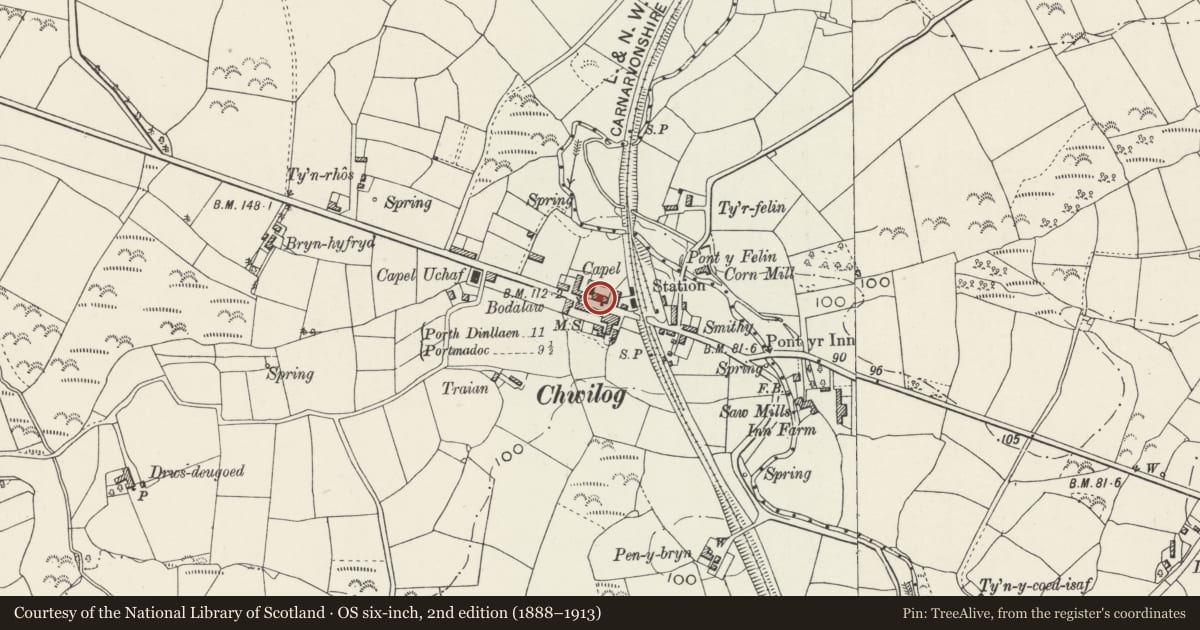
Slide toward Today to fade the historical sheet and see the modern map underneath.
David Rumsey Map Collection, Stanford LibrariesDavid Rumsey Map Collection, Stanford LibrariesDavid Rumsey Map Collection, Stanford LibrariesDavid Rumsey Map Collection, Stanford LibrariesLlyfrgell Genedlaethol Cymru – The National Library of Wales
5 historical maps cover this location, the earliest the 1795 map "To Sir Watkin Williams-Wynn Bart ... the map of the six counties of North Wales is most humbly inscribed by his obedient humble servant" (Llyfrgell Genedlaethol Cymru – The National Library of Wales).
Historical maps covering this location
- 1795 · To Sir Watkin Williams-Wynn Bart ... the map of the six counties of North Wales is most… (Llyfrgell Genedlaethol Cymru – The National Library of Wales)
- 1883 · Watershed map England, Wales 3. (David Rumsey Map Collection, Stanford Libraries)
- 1896 · Sheet 7. Ordnance Survey of England and Wales. (David Rumsey Map Collection, Stanford Libraries)
- 1899 · 118 Nevin (Hills) (David Rumsey Map Collection, Stanford Libraries)
- 1901 · Sheet 9 and 10. (David Rumsey Map Collection, Stanford Libraries)
Cadw's description
Location
The milestone is on the N side of the Chwilog village street, standing against the wall of a house known as Tegfan.
History
Milestones were erected by the trustees along the Turnpike road from Tremadoc to Porthdinllaen following the Act setting up the Porthdinllaen Turnpike Trust in 1808, part of the proposed new connection between Britain and Ireland.
Exterior
Standard Porthdinllaen turnpike milestone, consisting of a slate slab 7.5cm thick and 46cm wide, with the upper corners angled, and inscribed with deeply cut lettering reading: MILES / PORTHDINLLEYN 11 / NEVIN 10 / FOURCROSSES 2 / CRICCIETH 4 1/2 / PORTMADOG 9 1/2 / EDERN 10 1/2.
Reason for designation
Included as one well preserved milestone in the series erected by Porthdinllaen Turnpike Trust on the planned road to Ireland.
Nearby in the register
- Capel SilohReligious, Ritual and Funeraryunder 1 mi
- Post Office and attached HouseCommercialunder 1 mi
- Tafarn MadrynCommercialunder 1 mi
- Plas-y-nantDomesticunder 1 mi
Other entries of the same register within about three miles of this one, by straight line.