Cof Cymru: National Historic Assets of Wales · Wales
Tafarn Madryn
Llanystumdwy, Gwynedd, Wales
A Grade II listed building in Chwilog, Pwllheli, Llanystumdwy, Gwynedd, designated on 31 March 1999.
The record
- Designation
- Listed building, Grade II
- Broad class
- Commercial
- Date of designation
- 31 March 1999
- Locality
- Chwilog
- Town
- Pwllheli
- Community
- Llanystumdwy
- Unitary authority
- Gwynedd
- Country
- Wales
- Coordinates
- 52.92002, -4.33170
- Cadw reference
- 21589
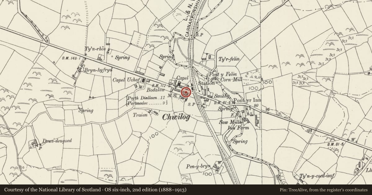
Slide toward Today to fade the historical sheet and see the modern map underneath.
David Rumsey Map Collection, Stanford LibrariesDavid Rumsey Map Collection, Stanford LibrariesDavid Rumsey Map Collection, Stanford LibrariesDavid Rumsey Map Collection, Stanford LibrariesLlyfrgell Genedlaethol Cymru – The National Library of Wales
5 historical maps cover this location, the earliest the 1795 map "To Sir Watkin Williams-Wynn Bart ... the map of the six counties of North Wales is most humbly inscribed by his obedient humble servant" (Llyfrgell Genedlaethol Cymru – The National Library of Wales).
Historical maps covering this location
- 1795 · To Sir Watkin Williams-Wynn Bart ... the map of the six counties of North Wales is most… (Llyfrgell Genedlaethol Cymru – The National Library of Wales)
- 1883 · Watershed map England, Wales 3. (David Rumsey Map Collection, Stanford Libraries)
- 1896 · Sheet 7. Ordnance Survey of England and Wales. (David Rumsey Map Collection, Stanford Libraries)
- 1899 · 118 Nevin (Hills) (David Rumsey Map Collection, Stanford Libraries)
- 1901 · Sheet 9 and 10. (David Rumsey Map Collection, Stanford Libraries)
Cadw's description
Location
The building stands at the end of a row of buildings at the village centre, against the former railway crossing.
History
Built in 1863 (date on gable end), partly to serve the new railway which passed nearby, with the station opposite.
Exterior
Rendered stonework, with a slate roof. Two storeys, 5 close spaced window bays with the entrance in the second bay from the left - a tall porch on cast iron Composite columns and canopy, and a 4-panelled door and overlight. Bays 1, 3, 4 and 5 have 12-pane sash windows to both floors, with a further window over the porch. The end elevation has a bold circular feature containing the date. Rear wing, altered C20 to incorporate the main entrance to the inn.
Interior
The interior has been altered in the C20.
Reason for designation
Included as a mid C19 public house still designed within the Georgian tradition, retaining original character externally and of group value with adjacent buildings in the centre of Chwilog.
Nearby in the register
- Post Office and attached HouseCommercialunder 1 mi
- MilestoneTransportunder 1 mi
- Capel SilohReligious, Ritual and Funeraryunder 1 mi
- Plas-y-nantDomesticunder 1 mi
Other entries of the same register within about three miles of this one, by straight line.