Cof Cymru: National Historic Assets of Wales · Wales
19 Bridge End Square
Haverfordwest, Pembrokeshire, Wales
A Grade II listed building in Haverfordwest, Pembrokeshire, designated on 22 March 1999.
The record
- Designation
- Listed building, Grade II
- Broad class
- Domestic
- Date of designation
- 22 March 1999
- Town
- Haverfordwest
- Community
- Haverfordwest
- Unitary authority
- Pembrokeshire
- Country
- Wales
- Coordinates
- 51.80466, -4.96687
- Cadw reference
- 21508
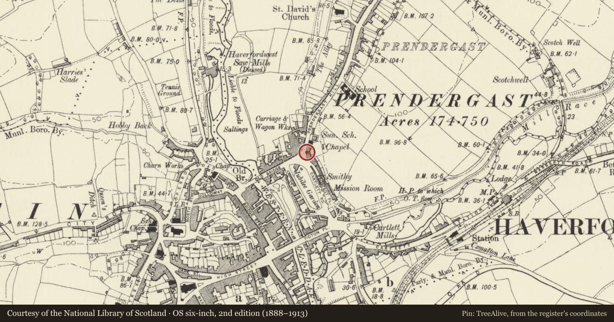
Slide toward Today to fade the historical sheet and see the modern map underneath.
David Rumsey Map Collection, Stanford LibrariesDavid Rumsey Map Collection, Stanford LibrariesDavid Rumsey Map Collection, Stanford LibrariesDavid Rumsey Map Collection, Stanford LibrariesDavid Rumsey Map Collection, Stanford Libraries
5 historical maps cover this location, the earliest the 1608 map "(13) Cambriae Typus." (David Rumsey Map Collection, Stanford Libraries).
Historical maps covering this location
- 1608 · (13) Cambriae Typus. (David Rumsey Map Collection, Stanford Libraries)
- 1636 · Cornubia : Devonia, Somersetus, Dorcestria, Wiltonia, Glocestria ... (David Rumsey Map Collection, Stanford Libraries)
- 1891 · Sheet 10. Ordnance Survey of England and Wales. . (David Rumsey Map Collection, Stanford Libraries)
- 1898 · 228 Haverfordwest (Hills) (David Rumsey Map Collection, Stanford Libraries)
- 1901 · Sheet 13. (David Rumsey Map Collection, Stanford Libraries)
Cadw's description
Location
Situated in terraced row running S from Hill Park Chapel, overlooking roundabout.
History
A C19 rebuilding of an earlier house on the site incorporating features of the earlier house including wing to rear with massive fireplace and chimney. In general the left (N) side of the house shows older features than the right.
Exterior
Terraced house, two storeys and attic, painted lined stucco with slate roof and banded brick chimney stacks. Raised plinth and band. Four-paned sash windows to two gabled attic dormers and two windows each floor, and central half-glazed door with blocked overlight. There was a broader former shop window in place of the left sash.. To rear, in roof slope, gable, and large (C18?) chimney. At right angles, partially built into slope, stone wing (corrugated roof covering), with massive stone chimney.
Interior
Ground floor has massive beam with some chamfered joists to left, sawn joists to right. Transverse stair to upper floors with some mid C19 doors/panelling. In rear wing, large archway to massive square chimney.
Reason for designation
Included for the special interest of the rare surviving early structure, especially the massive chimney.
Nearby in the register
- Hillside CottageNo class recordedunder 1 mi
- 25 Bridge End SquareDomesticunder 1 mi
- Hill Park Baptist ChurchReligious, Ritual and Funeraryunder 1 mi
- Railings, gates and gatepiers to Hill Park Baptist ChapelReligious, Ritual and Funeraryunder 1 mi
Other entries of the same register within about three miles of this one, by straight line.