Cof Cymru: National Historic Assets of Wales · Wales
Railings, gates and gatepiers to Hill Park Baptist Chapel
Haverfordwest, Pembrokeshire, Wales
A Grade II listed building in Haverfordwest, Pembrokeshire, designated on 1 July 1974.
The record
- Designation
- Listed building, Grade II
- Broad class
- Religious, Ritual and Funerary
- Date of designation
- 1 July 1974
- Town
- Haverfordwest
- Community
- Haverfordwest
- Unitary authority
- Pembrokeshire
- Country
- Wales
- Coordinates
- 51.80505, -4.96679
- Cadw reference
- 12207
Slide toward Today to fade the historical sheet and see the modern map underneath.
David Rumsey Map Collection, Stanford LibrariesDavid Rumsey Map Collection, Stanford LibrariesDavid Rumsey Map Collection, Stanford LibrariesDavid Rumsey Map Collection, Stanford LibrariesDavid Rumsey Map Collection, Stanford Libraries
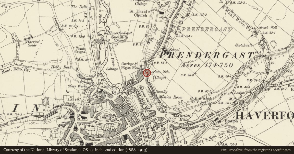
5 historical maps cover this location, the earliest the 1608 map "(13) Cambriae Typus." (David Rumsey Map Collection, Stanford Libraries).
Historical maps covering this location
- 1608 · (13) Cambriae Typus. (David Rumsey Map Collection, Stanford Libraries)
- 1636 · Cornubia : Devonia, Somersetus, Dorcestria, Wiltonia, Glocestria ... (David Rumsey Map Collection, Stanford Libraries)
- 1891 · Sheet 10. Ordnance Survey of England and Wales. . (David Rumsey Map Collection, Stanford Libraries)
- 1898 · 228 Haverfordwest (Hills) (David Rumsey Map Collection, Stanford Libraries)
- 1901 · Sheet 13. (David Rumsey Map Collection, Stanford Libraries)
Cadw's description
Location
Situated on roadside in front of terraced courtyard to chapel and schoolroom.
History
Terrace wall with railings and gatepiers at left end, probably contemporary with the first Hill Park Baptist chapel, of 1858. The gates once had an iron overthrow and lamp.
Exterior
Retaining wall of grey limestone in front of chapel terrace, rising with fall of ground to right. Raised plinth and grey stone pier at right end. Sandstone coping with spearhead iron railings, round section with cast-iron finials. At left end two monolith sandstone piers with plinths and square caps frame a single gate with dog bars, matching railings.
Reason for designation
Included for group value with the chapel and schoolroom.
Nearby in the register
- Hill Park Baptist ChurchReligious, Ritual and Funeraryunder 1 mi
- Sunday School to Hill Park Baptist ChurchReligious, Ritual and Funeraryunder 1 mi
- 25 Bridge End SquareDomesticunder 1 mi
- Hillside CottageNo class recordedunder 1 mi
Other entries of the same register within about three miles of this one, by straight line.