Cof Cymru: National Historic Assets of Wales · Wales
Gordon House
Usk, Monmouthshire, Wales
A Grade II listed building in Usk, Monmouthshire, designated on 1 April 1974.
The record
- Designation
- Listed building, Grade II
- Broad class
- Domestic
- Date of designation
- 1 April 1974
- Locality
- Usk
- Town
- Usk
- Community
- Usk
- Unitary authority
- Monmouthshire
- Country
- Wales
- Coordinates
- 51.70285, -2.90474
- Cadw reference
- 2130
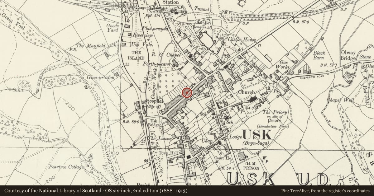
Slide toward Today to fade the historical sheet and see the modern map underneath.
David Rumsey Map Collection, Stanford LibrariesDavid Rumsey Map Collection, Stanford LibrariesDavid Rumsey Map Collection, Stanford LibrariesDavid Rumsey Map Collection, Stanford LibrariesDavid Rumsey Map Collection, Stanford Libraries
5 historical maps cover this location, the earliest the 1636 map "Cornubia : Devonia, Somersetus, Dorcestria, Wiltonia, Glocestria ..." (David Rumsey Map Collection, Stanford Libraries).
Historical maps covering this location
- 1636 · Cornubia : Devonia, Somersetus, Dorcestria, Wiltonia, Glocestria ... (David Rumsey Map Collection, Stanford Libraries)
- 1637 · The fourth table of England. Cornub. Devonia, Somerset etc. (David Rumsey Map Collection, Stanford Libraries)
- 1830 · V.3:11-15:XV.Britisches Reich. A. Kon: England. a. England ab sich: Shire:15-17, 33 (David Rumsey Map Collection, Stanford Libraries)
- 1895 · Sheet 11. Ordnance Survey of England and Wales. (David Rumsey Map Collection, Stanford Libraries)
- 1913 · Sheet 102. Newport. (David Rumsey Map Collection, Stanford Libraries)
Cadw's description
Location
Roughly halfway along the N range of Bridge Street, stepped back from No.12.
History
Steep-pitched roof and eaves swept out over frontage and blocked mullion window confirm an early (C17?) building which was later re-fronted in early to mid C19; the twin doorways suggest conversion then to a pair of townhouses.
Exterior
Georgian-fronted townhouse, attached at each side. Of rendered stone rubble, this visible in gable end left. Steep-pitched slate roof with noticeably swept and overhanging eaves; brick corniced end stacks. Two storeys and cellar. Two-window range of tri-partite sashes in deep reveals with painted surrounds and tiny bracketed sills. Architraves to ground floor windows with low sills to plinth level. Paired doorways at centre with pilasters, entablature and pediment over; door is margin-glazed to right and 5-panelled to left.
Interior
Interior reported to retain open fireplace, stone arch, heavy A-frame roof trusses with notched collars.
Reason for designation
Listed as a townhouse retaining historic fabric and character. Group value with other listed buildings in Bridge Street.
Nearby in the register
- Ty TadcuDomesticunder 1 mi
- 47 & 49 and attached iron railings and attached archwayCommercialunder 1 mi
- Bridge Street, and iron forecourt railingsDomesticunder 1 mi
- 47 & 49 and attached iron railings and attached archwayDomesticunder 1 mi
Other entries of the same register within about three miles of this one, by straight line.