Cof Cymru: National Historic Assets of Wales · Wales
Bridge Street, and iron forecourt railings
Usk, Monmouthshire, Wales
A Grade II listed building in Usk, Monmouthshire, designated on 30 April 2004.
The record
- Designation
- Listed building, Grade II
- Broad class
- Domestic
- Date of designation
- 30 April 2004
- Locality
- Usk
- Town
- Usk
- Community
- Usk
- Unitary authority
- Monmouthshire
- Country
- Wales
- Coordinates
- 51.70309, -2.90440
- Cadw reference
- 82774
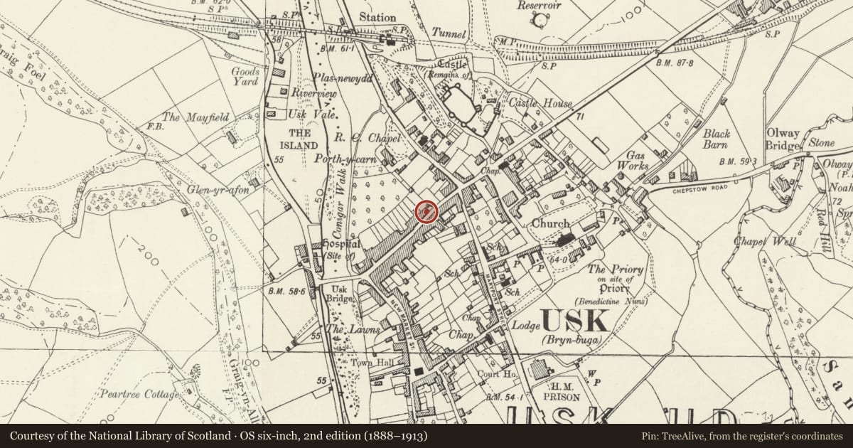
Slide toward Today to fade the historical sheet and see the modern map underneath.
David Rumsey Map Collection, Stanford LibrariesDavid Rumsey Map Collection, Stanford LibrariesDavid Rumsey Map Collection, Stanford LibrariesDavid Rumsey Map Collection, Stanford LibrariesDavid Rumsey Map Collection, Stanford Libraries
5 historical maps cover this location, the earliest the 1636 map "Cornubia : Devonia, Somersetus, Dorcestria, Wiltonia, Glocestria ..." (David Rumsey Map Collection, Stanford Libraries).
Historical maps covering this location
- 1636 · Cornubia : Devonia, Somersetus, Dorcestria, Wiltonia, Glocestria ... (David Rumsey Map Collection, Stanford Libraries)
- 1637 · The fourth table of England. Cornub. Devonia, Somerset etc. (David Rumsey Map Collection, Stanford Libraries)
- 1830 · V.3:11-15:XV.Britisches Reich. A. Kon: England. a. England ab sich: Shire:15-17, 33 (David Rumsey Map Collection, Stanford Libraries)
- 1895 · Sheet 11. Ordnance Survey of England and Wales. (David Rumsey Map Collection, Stanford Libraries)
- 1913 · Sheet 102. Newport. (David Rumsey Map Collection, Stanford Libraries)
Cadw's description
Location
About 80m west of junction with Maryport Street
History
House, now offices of circa 1900/1910.
Exterior
Offices in Queen Anne revival style. Two storeys, painted render, slate roofs. Sash glazing with small panes in the upper sashes. Main block of 3-windows width has two pedimental gables with dentil cornices; deep dentil cornice also to eaves. On upper floor, central window is flanked by large splayed oriels windows. Moulded string course between storeys breaks upward over doorway to link with upper window. On ground floor, central doorway with Gibbs surround; semi-circular head with overlight; panelled doors. Pair of sash windows to each side of doorway in architraves with keystones. To R, further bay with single window on upper floor and vehicle entry below. Iron railings to forecourt of main block.
Reason for designation
Well-designed house in early C18 style.
Nearby in the register
- 25 Bridge StreetCommercialunder 1 mi
- Gordon HouseDomesticunder 1 mi
- Garden Wall at The Three Salmons HotelDomesticunder 1 mi
- Ty TadcuDomesticunder 1 mi
Other entries of the same register within about three miles of this one, by straight line.