Cof Cymru: National Historic Assets of Wales · Wales
Penrhos
Aberdaron, Gwynedd, Wales
A Grade II listed building in Rhoshirwaun, Pwllheli, Aberdaron, Gwynedd, designated on 26 June 1998.
The record
- Designation
- Listed building, Grade II
- Broad class
- Domestic
- Date of designation
- 26 June 1998
- Locality
- Rhoshirwaun
- Town
- Pwllheli
- Community
- Aberdaron
- Unitary authority
- Gwynedd
- Country
- Wales
- Coordinates
- 52.83381, -4.68621
- Cadw reference
- 20040
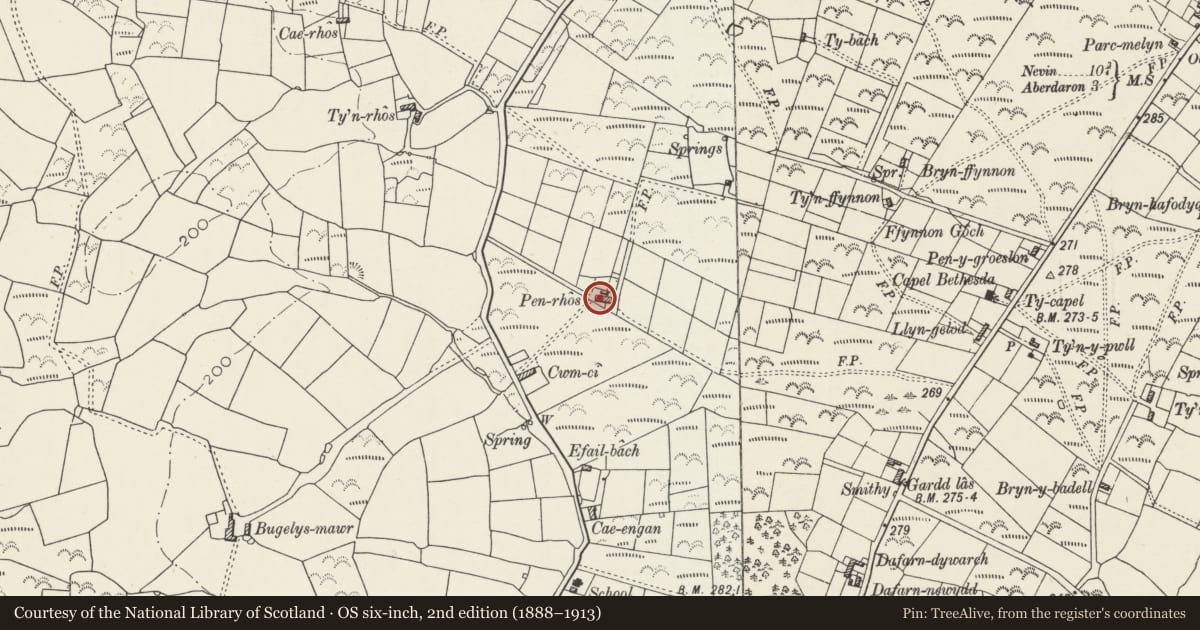
Slide toward Today to fade the historical sheet and see the modern map underneath.
David Rumsey Map Collection, Stanford LibrariesDavid Rumsey Map Collection, Stanford LibrariesDavid Rumsey Map Collection, Stanford LibrariesDavid Rumsey Map Collection, Stanford LibrariesDavid Rumsey Map Collection, Stanford Libraries
5 historical maps cover this location, the earliest the 1608 map "(13) Cambriae Typus." (David Rumsey Map Collection, Stanford Libraries).
Historical maps covering this location
- 1608 · (13) Cambriae Typus. (David Rumsey Map Collection, Stanford Libraries)
- 1830 · V.3:11-15:XV. Britisches Reich. A. Kon: England. b. Frstenthum Wales: Shire: 37-40 (David Rumsey Map Collection, Stanford Libraries)
- 1883 · Watershed map England, Wales 3. (David Rumsey Map Collection, Stanford Libraries)
- 1898 · 133 Bardsey Island (Hills) (David Rumsey Map Collection, Stanford Libraries)
- 1901 · Sheet 9 and 10. (David Rumsey Map Collection, Stanford Libraries)
Cadw's description
Location
Situated adjoining No 2 Penrhos, down track running E from lane W of Rhoshirwaun, some 500m N of school.
History
One of a pair of croglofft cottages, of clay wall construction, a type that seems to be of mid C19 date in the region, and is now becoming rare. Not apparently marked on 1844 Aberdaron Tithe Map, though a holding called Penrhos is named, owned by David Evans, occupied by John Williams, with 23 acres (9.3ha).
Exterior
Cottage, pebble-dashed with slate roof and brick end stacks, left stack on ridge to No 2 Penrhos adjoining. Single storey, double-fronted with 6-pane sash each side of half-glazed door. Earth wall construction as on No 2, where it is more obviously exposed. Outbuilding attached on right end. Pebbledashed rear with one boarded opening to right.
Reason for designation
Included as part of a pair of mud-walled cottages, a building type becoming very rare in the region. Group value with No 2 Penrhos.
Nearby in the register
- PenrhosDomesticunder 1 mi
- Ardd Las / Efail RhosDomesticunder 1 mi
- MilestoneTransportunder 1 mi
- Castell OdoHillfortunder 1 mi
Other entries of the same register within about three miles of this one, by straight line.