Cof Cymru: National Historic Assets of Wales · Wales
Terraces at Plas yn Rhiw
Aberdaron, Gwynedd, Wales
A Grade II listed building in Rhiw Plas, Pwllheli, Aberdaron, Gwynedd, designated on 26 June 1998.
The record
- Designation
- Listed building, Grade II
- Broad class
- Domestic
- Date of designation
- 26 June 1998
- Locality
- Rhiw Plas
- Town
- Pwllheli
- Community
- Aberdaron
- Unitary authority
- Gwynedd
- Country
- Wales
- Coordinates
- 52.82259, -4.61891
- Cadw reference
- 20033
Slide toward Today to fade the historical sheet and see the modern map underneath.
David Rumsey Map Collection, Stanford LibrariesDavid Rumsey Map Collection, Stanford LibrariesDavid Rumsey Map Collection, Stanford LibrariesDavid Rumsey Map Collection, Stanford LibrariesDavid Rumsey Map Collection, Stanford Libraries
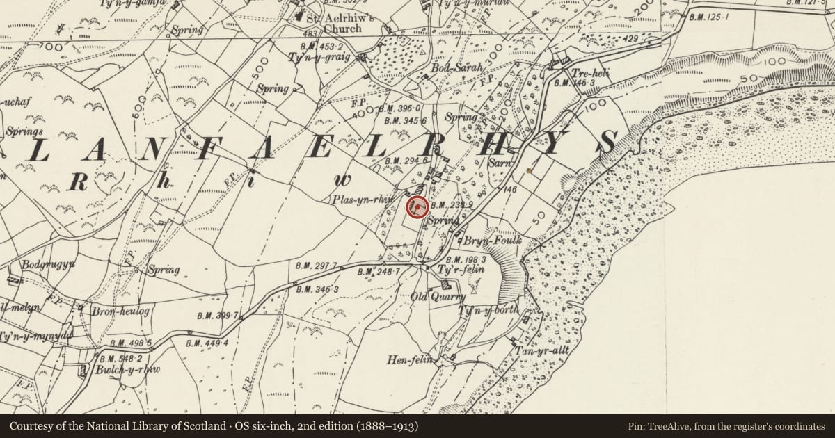
5 historical maps cover this location, the earliest the 1608 map "(13) Cambriae Typus." (David Rumsey Map Collection, Stanford Libraries).
Historical maps covering this location
- 1608 · (13) Cambriae Typus. (David Rumsey Map Collection, Stanford Libraries)
- 1830 · V.3:11-15:XV. Britisches Reich. A. Kon: England. b. Frstenthum Wales: Shire: 37-40 (David Rumsey Map Collection, Stanford Libraries)
- 1883 · Watershed map England, Wales 3. (David Rumsey Map Collection, Stanford Libraries)
- 1899 · 134 Pwllheli (Hills) (David Rumsey Map Collection, Stanford Libraries)
- 1901 · Sheet 9 and 10. (David Rumsey Map Collection, Stanford Libraries)
Cadw's description
Location
Situated immediately in front of Plas-yn-Rhiw.
History
Retaining wall to terrace platform in front of Plas-yn-Rhiw and wall running eastward along N edge of garden. Uncertain date, possibly earlier C19 to match the remodelling of the house in 1820, possibly earlier.
Exterior
Terrace wall, rubble stone, of some 16m, with some 18m length of wall at right angles, running E from N end to enclose N side of garden. Wall has door at W end and C19 privy attached behind with lean-to slate roof. 2 seats in privy.
Reason for designation
Included as integral part of the setting of Plas-yn-Rhiw.
Nearby in the register
- Workshop at Plas yn RhiwDomesticunder 1 mi
- Plas yn RhiwDomesticunder 1 mi
- Bwthyn yr Ardd at Plas yn RhiwDomesticunder 1 mi
- Cartshed at Plas yn RhiwDomesticunder 1 mi
Other entries of the same register within about three miles of this one, by straight line.