Cof Cymru: National Historic Assets of Wales · Wales
The Post Office
Aberdaron, Gwynedd, Wales
A Grade II listed building in Aberdaron, Pwllheli, Gwynedd, designated on 26 June 1998.
The record
- Designation
- Listed building, Grade II
- Broad class
- Domestic
- Date of designation
- 26 June 1998
- Locality
- Aberdaron
- Town
- Pwllheli
- Community
- Aberdaron
- Unitary authority
- Gwynedd
- Country
- Wales
- Coordinates
- 52.80416, -4.71278
- Cadw reference
- 19990
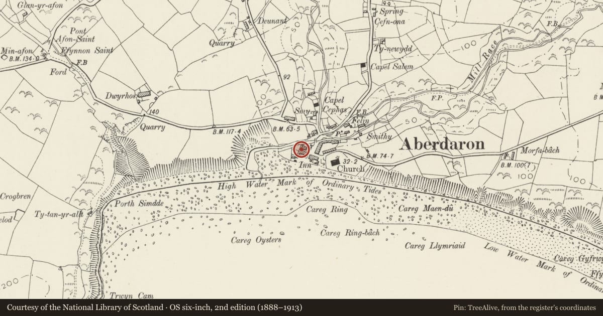
Slide toward Today to fade the historical sheet and see the modern map underneath.
David Rumsey Map Collection, Stanford LibrariesDavid Rumsey Map Collection, Stanford LibrariesDavid Rumsey Map Collection, Stanford LibrariesDavid Rumsey Map Collection, Stanford LibrariesDavid Rumsey Map Collection, Stanford Libraries
5 historical maps cover this location, the earliest the 1608 map "(13) Cambriae Typus." (David Rumsey Map Collection, Stanford Libraries).
Historical maps covering this location
- 1608 · (13) Cambriae Typus. (David Rumsey Map Collection, Stanford Libraries)
- 1637 · Particular description of Wales. Cambria seu Wallia (David Rumsey Map Collection, Stanford Libraries)
- 1883 · Watershed map England, Wales 3. (David Rumsey Map Collection, Stanford Libraries)
- 1898 · 133 Bardsey Island (Hills) (David Rumsey Map Collection, Stanford Libraries)
- 1901 · Sheet 9 and 10. (David Rumsey Map Collection, Stanford Libraries)
Cadw's description
Location
In the centre of Aberdaron village, set back and overlooking the open square on the W side of its main street.
History
Former post-office now holiday house, 1950 by Sir Clough Williams-Ellis.
Exterior
Former Post Office. Whitewashed squared rubble stone to E facade with roof of small slates and single whitewashed stone-capped stack on ridge left of centre. Two storeys, with interesting disposal of windows, 4x12-pane sashes to ground floor, 2 each side of arched door, two smaller 12-pane sashes above each set between the two below and centre small-paned arched window with radiating-bar head, set higher and breaking through eaves under centre pedimental gable. Slab lintels except to arches which have stone voussoirs, slate sills, ledged door. Attractively engraved oval slate plaque to left with 'G VI R' monogram. Utilitarian rendered end walls and rear with later plastic windows.
Reason for designation
A carefully designed and sympathetic C20 addition to the village, by one of the leading traditionalist architects of Wales.
Nearby in the register
- Glasfor, Gwynfor & Uwch-y-DonDomesticunder 1 mi
- Y Gegin FawrDomesticunder 1 mi
- Pont FawrTransportunder 1 mi
- Row of 5 Cottages North of & opposite Church of St HywynDomesticunder 1 mi
Other entries of the same register within about three miles of this one, by straight line.