Cof Cymru: National Historic Assets of Wales · Wales
Hendy
Llanengan, Gwynedd, Wales
A Grade II listed building in Abersoch, Pwllheli, Llanengan, Gwynedd, designated on 1 April 1998.
The record
- Designation
- Listed building, Grade II
- Broad class
- Domestic
- Date of designation
- 1 April 1998
- Locality
- Abersoch
- Town
- Pwllheli
- Community
- Llanengan
- Unitary authority
- Gwynedd
- Country
- Wales
- Coordinates
- 52.82554, -4.51594
- Cadw reference
- 19635
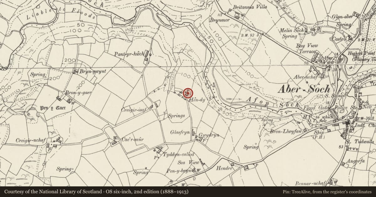
Slide toward Today to fade the historical sheet and see the modern map underneath.
David Rumsey Map Collection, Stanford LibrariesDavid Rumsey Map Collection, Stanford LibrariesDavid Rumsey Map Collection, Stanford LibrariesDavid Rumsey Map Collection, Stanford LibrariesDavid Rumsey Map Collection, Stanford Libraries
5 historical maps cover this location, the earliest the 1830 map "V.3:11-15:XV. Britisches Reich. A. Kon: England. b. Frstenthum Wales: Shire: 37-40" (David Rumsey Map Collection, Stanford Libraries).
Historical maps covering this location
- 1830 · V.3:11-15:XV. Britisches Reich. A. Kon: England. b. Frstenthum Wales: Shire: 37-40 (David Rumsey Map Collection, Stanford Libraries)
- 1883 · Watershed map England, Wales 3. (David Rumsey Map Collection, Stanford Libraries)
- 1896 · Sheet 7. Ordnance Survey of England and Wales. (David Rumsey Map Collection, Stanford Libraries)
- 1899 · 134 Pwllheli (Hills) (David Rumsey Map Collection, Stanford Libraries)
- 1901 · Sheet 9 and 10. (David Rumsey Map Collection, Stanford Libraries)
Cadw's description
Location
Situated down track some 200m from minor lane NW of Abersoch, turning just past Tan y gaer estate.
History
Early C19 farmhouse marked on 1839 Tithe map as owned and occupied by Owen Jones with 25 acres (10ha).
Exterior
Farmhouse, roughcast rubble stone with slate close-eaved roof and rendered end stacks. Two-storey, three-window E front of large 16-pane hornless sashes and centre door. Six-panel door with 4-pane overlight in open timber porch of two turned posts with slate gable and fretwork timber panel in gable. N end is rubble stone with small 16-pane first floor sash and 12-pane ground floor sash, both set to right. S end is roughcast with first floor 12-pane sash. Rear has outshut to left and wing to right. Mounting block on W end.
Reason for designation
A vernacular farmhouse retaining a good late Georgian style facade with original door and windows.
Nearby in the register
- Creigir IsafDomesticunder 1 mi
- PenygraigDomesticunder 1 mi
- The Lodge at HaulfrynDomesticunder 1 mi
- The Squash Court at HaulfrynRecreationalunder 1 mi
Other entries of the same register within about three miles of this one, by straight line.