Cof Cymru: National Historic Assets of Wales · Wales
Enclosure walls, steps and memorial plaque to Quaker Burial Ground at Werndriw
Llanddewi Brefi, Ceredigion, Wales
A Grade II listed building in Llanfair Road, Llanddewi Brefi, Ceredigion, designated on 30 September 1997.
The record
- Designation
- Listed building, Grade II
- Broad class
- Religious, Ritual and Funerary
- Date of designation
- 30 September 1997
- Locality
- Llanfair Road
- Community
- Llanddewi Brefi
- Unitary authority
- Ceredigion
- Country
- Wales
- Coordinates
- 52.17446, -3.96578
- Cadw reference
- 18949
Slide toward Today to fade the historical sheet and see the modern map underneath.
David Rumsey Map Collection, Stanford LibrariesDavid Rumsey Map Collection, Stanford LibrariesDavid Rumsey Map Collection, Stanford LibrariesDavid Rumsey Map Collection, Stanford LibrariesDavid Rumsey Map Collection, Stanford Libraries
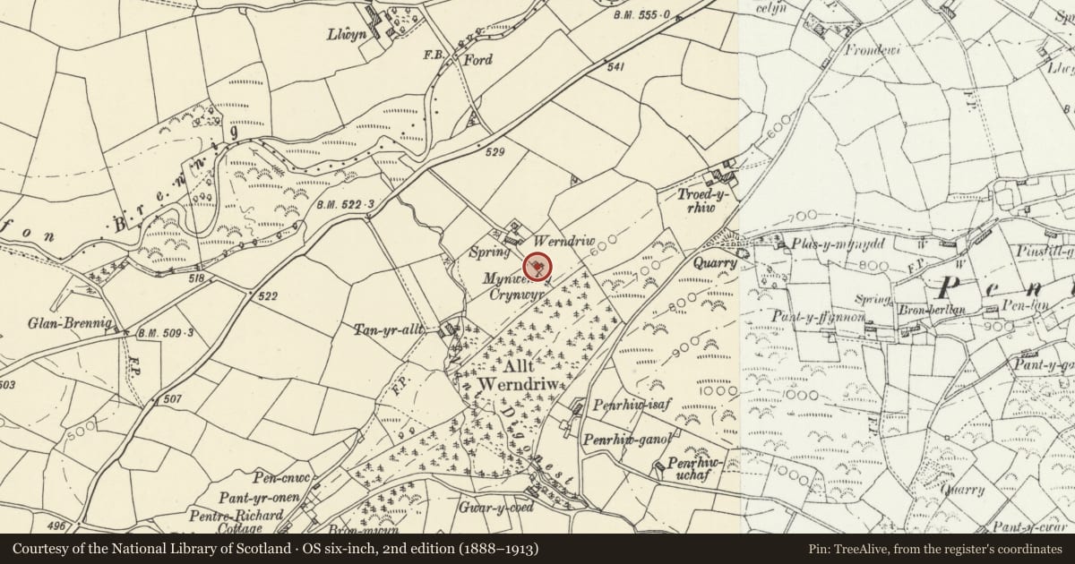
5 historical maps cover this location, the earliest the 1608 map "(13) Cambriae Typus." (David Rumsey Map Collection, Stanford Libraries).
Historical maps covering this location
- 1608 · (13) Cambriae Typus. (David Rumsey Map Collection, Stanford Libraries)
- 1637 · Particular description of Wales. Cambria seu Wallia (David Rumsey Map Collection, Stanford Libraries)
- 1830 · V.3:11-15:XV. Britisches Reich. A. Kon: England. b. Frstenthum Wales: Shire: 37-40 (David Rumsey Map Collection, Stanford Libraries)
- 1899 · 195 Lampeter (Hills) (David Rumsey Map Collection, Stanford Libraries)
- 1901 · Sheet 14. (David Rumsey Map Collection, Stanford Libraries)
Cadw's description
Location
Situated on hill-slope some 70m SE of Werndriw, which lies 1 km WSW of Llanddewi Brefi, down drive running S from B4343.
History
C18 Quaker burial ground. Werndriw was an ancient house belonging to the George family c1700 and the Jenkins family in the late C18, described as very dilapidated in 1860. Friends' meetings seem to have been held there from the time of Samuel George (d1712) and his sister Ann Evans. The graveyard wall was rebuilt in the C19 (before 1874) by Mrs Jenkins and kept in repair by T. Hughes of Neuadd Fawr, nr Lampeter, owner c1900.
Exterior
Small graveyard enclosed by rubble stone walls of some 2 m height at upper end and 1.5 m at lower. E side has 3 stone slab steps up and 3 down within. On E wall is memorial, slate plaque in stone surround with simple pediment. The inscription reads 'In this sequestered spot repose the mortal remains of John Jenkins, of Werndriw, and of Anne, his wife. She died September 1771 and he February 1790. Here also lie buried their five children Thomas Henry, William, John, Anne Elizabeth and Maria Letitia. David Joel Jenkins of Lampeter, the sole surviving child of the said John and Anne Jenkins placed this tablet in affectionate remembrance of father, mother, brothers, sisters.'
Reason for designation
Listed as an unusual survival, historically important as the only such in Cardiganshire.
Nearby in the register
- 1 Penuwch StreetDomesticunder 1 mi
- 2 Penuwch StreetDomesticunder 1 mi
- 3 Penuwch StreetDomesticunder 1 mi
- Telephone Call-box W of Foelallt Arms (01974 298200)Communicationsunder 1 mi
Other entries of the same register within about three miles of this one, by straight line.