Cof Cymru: National Historic Assets of Wales · Wales
1 Penuwch Street
Llanddewi Brefi, Ceredigion, Wales
A Grade II listed building in Llanddewi Brefi, Ceredigion, designated on 10 February 1994.
The record
- Designation
- Listed building, Grade II
- Broad class
- Domestic
- Date of designation
- 10 February 1994
- Locality
- Llanddewi Brefi
- Community
- Llanddewi Brefi
- Unitary authority
- Ceredigion
- Country
- Wales
- Coordinates
- 52.17826, -3.95606
- Cadw reference
- 15652
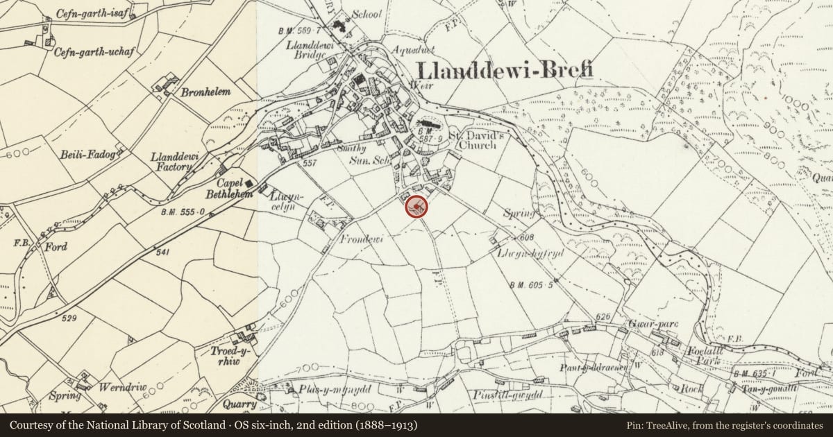
Slide toward Today to fade the historical sheet and see the modern map underneath.
David Rumsey Map Collection, Stanford LibrariesDavid Rumsey Map Collection, Stanford LibrariesDavid Rumsey Map Collection, Stanford LibrariesDavid Rumsey Map Collection, Stanford LibrariesDavid Rumsey Map Collection, Stanford Libraries
5 historical maps cover this location, the earliest the 1608 map "(13) Cambriae Typus." (David Rumsey Map Collection, Stanford Libraries).
Historical maps covering this location
- 1608 · (13) Cambriae Typus. (David Rumsey Map Collection, Stanford Libraries)
- 1637 · Particular description of Wales. Cambria seu Wallia (David Rumsey Map Collection, Stanford Libraries)
- 1830 · V.3:11-15:XV. Britisches Reich. A. Kon: England. b. Frstenthum Wales: Shire: 37-40 (David Rumsey Map Collection, Stanford Libraries)
- 1899 · 195 Lampeter (Hills) (David Rumsey Map Collection, Stanford Libraries)
- 1901 · Sheet 14. (David Rumsey Map Collection, Stanford Libraries)
Cadw's description
Location
Situated at S edge of Llanddewi Brefi village, set back from Farmers road, approached by track beside Memorial Hall. Set in rubble-walled and partly cobbled forecourt.
History
One of row of three cottages, also known as Penrhiw Ganol. No 1 possibly later C18, Nos. 2 and 3 earlier C19, all marked on 1845 Tithe Map, but probably altered later in C19. No 1 said to have been used as a school in mid C19.
Exterior
Rubble stone with slate roof and stone end stacks, right stack shared with No 2. Two-storey, double-fronted facade offset to right. Roofline lower than No 2. Two small 4-pane windows to upper floor above 2 later C19 or C20 4-pane horned sashes with cemented lintels. Ledged door off-centre between, with stone slab lintel.
Reason for designation
Listed for being the earliest part of the best surviving of the terraced rows typical of Llanddewi Brefi. Group value with Nos. 2 and 3.
Nearby in the register
- 2 Penuwch StreetDomesticunder 1 mi
- 3 Penuwch StreetDomesticunder 1 mi
- Telephone Call-box W of Foelallt Arms (01974 298200)Communicationsunder 1 mi
- Four Inscribed Stones in ChurchInscribed Stoneunder 1 mi
Other entries of the same register within about three miles of this one, by straight line.