Cof Cymru: National Historic Assets of Wales · Wales
Neuadd
Llanddewi Brefi, Ceredigion, Wales
A Grade II listed building in Pentre Rhew, Llanddewi Brefi, Ceredigion, designated on 30 September 1997.
The record
- Designation
- Listed building, Grade II
- Broad class
- Domestic
- Date of designation
- 30 September 1997
- Locality
- Pentre Rhew
- Community
- Llanddewi Brefi
- Unitary authority
- Ceredigion
- Country
- Wales
- Coordinates
- 52.17596, -3.95072
- Cadw reference
- 18946
Slide toward Today to fade the historical sheet and see the modern map underneath.
David Rumsey Map Collection, Stanford LibrariesDavid Rumsey Map Collection, Stanford LibrariesDavid Rumsey Map Collection, Stanford LibrariesDavid Rumsey Map Collection, Stanford LibrariesDavid Rumsey Map Collection, Stanford Libraries
5 historical maps cover this location, the earliest the 1608 map "(13) Cambriae Typus." (David Rumsey Map Collection, Stanford Libraries).
Historical maps covering this location
- 1608 · (13) Cambriae Typus. (David Rumsey Map Collection, Stanford Libraries)
- 1637 · Particular description of Wales. Cambria seu Wallia (David Rumsey Map Collection, Stanford Libraries)
- 1830 · V.3:11-15:XV. Britisches Reich. A. Kon: England. b. Frstenthum Wales: Shire: 37-40 (David Rumsey Map Collection, Stanford Libraries)
- 1899 · 195 Lampeter (Hills) (David Rumsey Map Collection, Stanford Libraries)
- 1901 · Sheet 14. (David Rumsey Map Collection, Stanford Libraries)
Cadw's description
Location
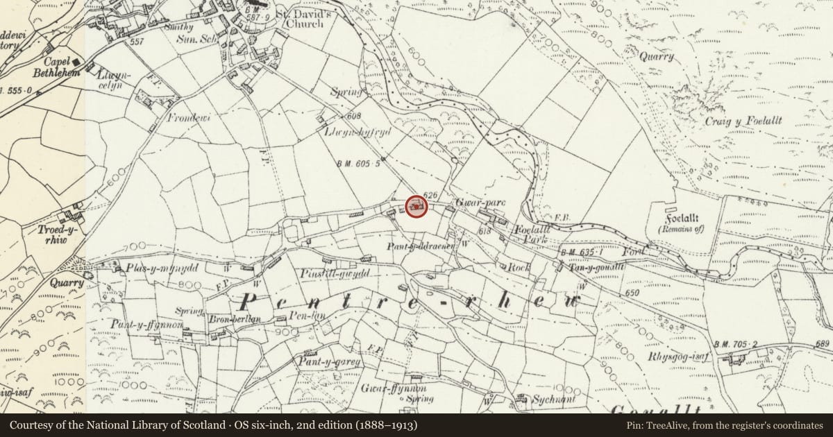
Situated some 600m SE of Llanddewi Brefi, facing across minor lane running W from junction with Brefi valley road. Set behind front garden enclosed by whitewashed rubble walls.
History
Mid C18 house altered in C19. Built in 1758 by David Daniel according to date plaque.
Exterior
Whitewashed rubble stone with slate roofs, and C20 whitewashed brick end stacks. Two-storey, three-window main range of horned sashes with slate sills and stone slab lintels. 2-pane sashes above, 4-pane below. Centre 4-panel door with overlight. Date plaque over door: 'David Daniel built this house 1758'. Attached to right is lower service range with cambered-headed door to left, with stone voussoirs, 4-pane sash to right with stone slab lintel, and larger horned 4-pane sash above. To right, an added lean-to with two ledged doors under a single timber lintel. Attached to left is added lofted stable to same roof height. One large upper boarded loft door to centre, plank door to ground floor right and small boarded window to left, both with brick heads.
Reason for designation
Listed as good traditional range of vernacular buildings, with core of a farmhouse of 1758.
Nearby in the register
- Barn to W of NeuaddAgriculture and Subsistenceunder 1 mi
- 3 Penuwch StreetDomesticunder 1 mi
- 2 Penuwch StreetDomesticunder 1 mi
- 1 Penuwch StreetDomesticunder 1 mi
Other entries of the same register within about three miles of this one, by straight line.