Cof Cymru: National Historic Assets of Wales · Wales
Cowhouse Range at Llawhaden House
Llawhaden, Pembrokeshire, Wales
A Grade II listed building in Llawhaden Village, Llawhaden, Pembrokeshire, designated on 11 August 1997.
The record
- Designation
- Listed building, Grade II
- Broad class
- Agriculture and Subsistence
- Date of designation
- 11 August 1997
- Locality
- Llawhaden Village
- Community
- Llawhaden
- Unitary authority
- Pembrokeshire
- Country
- Wales
- Coordinates
- 51.82193, -4.80278
- Cadw reference
- 18795
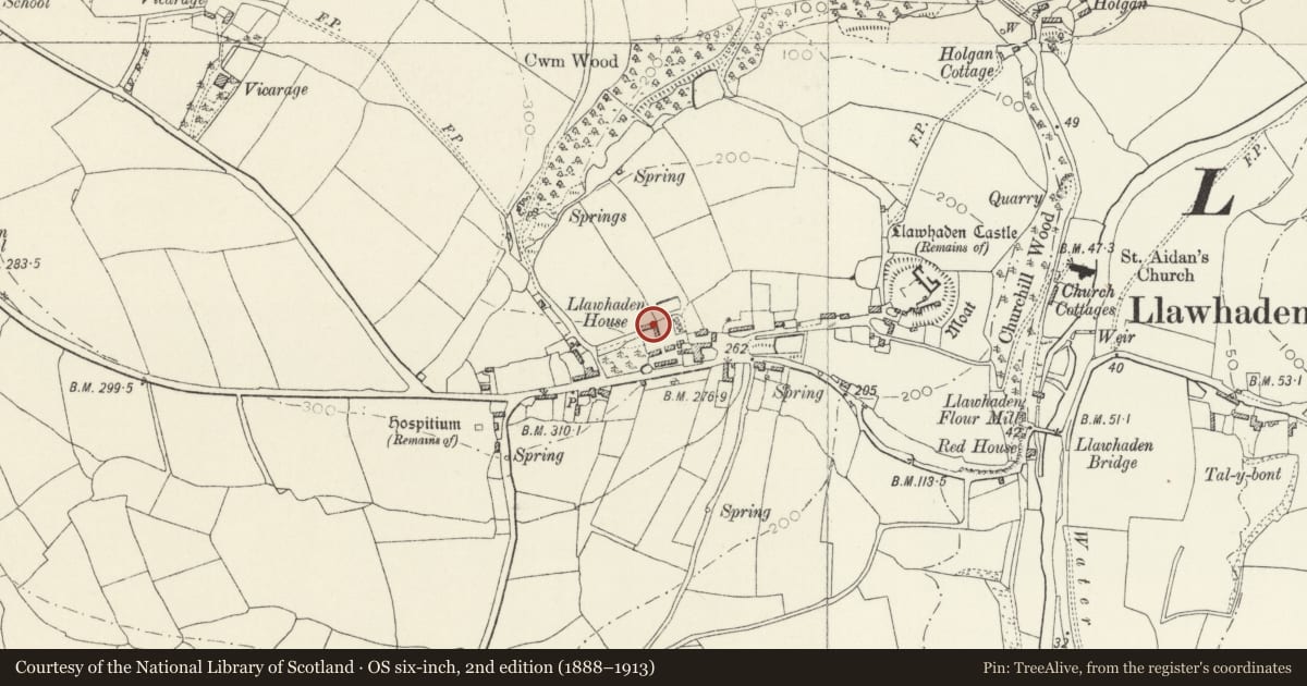
Slide toward Today to fade the historical sheet and see the modern map underneath.
David Rumsey Map Collection, Stanford LibrariesDavid Rumsey Map Collection, Stanford LibrariesDavid Rumsey Map Collection, Stanford LibrariesDavid Rumsey Map Collection, Stanford LibrariesDavid Rumsey Map Collection, Stanford Libraries
5 historical maps cover this location, the earliest the 1636 map "Cornubia : Devonia, Somersetus, Dorcestria, Wiltonia, Glocestria ..." (David Rumsey Map Collection, Stanford Libraries).
Historical maps covering this location
- 1636 · Cornubia : Devonia, Somersetus, Dorcestria, Wiltonia, Glocestria ... (David Rumsey Map Collection, Stanford Libraries)
- 1830 · V.3:11-15:XV. Britisches Reich. A. Kon: England. b. Frstenthum Wales: Shire: 37-40 (David Rumsey Map Collection, Stanford Libraries)
- 1891 · Sheet 10. Ordnance Survey of England and Wales. . (David Rumsey Map Collection, Stanford Libraries)
- 1898 · 228 Haverfordwest (Hills) (David Rumsey Map Collection, Stanford Libraries)
- 1901 · Sheet 13. (David Rumsey Map Collection, Stanford Libraries)
Cadw's description
Location
In the farmyard of Llawhaden House, about 50 m W of the dovecote, forming the N and E sides of a yard of which the milking shed forms the S.
History
Probably early C19. The building appears on the 1839 Tithe Plan.
Exterior
An L-shaped range, single storey, built in rubble masonry which in places is informally brought to courses. Larger stones are selected for the quoins. Slate roof with tile ridges, partly replaced by tiles. The E/W wing faces S and the N/S wing faces W. At the W of the E/W wing there are three cart-sheds, but the remainder of the building consists of cow or calf sheds. There are ventilators or small windows on all sides.
Doors facing S and W are boarded, with ventilation gaps between door and frame. Flat brick arches above. Slit ventilators at intervals and two small openings.
The three cart-shed arches are semi-elliptical, bearing on square stone piers. Each stone arch is backed up by a massive oak beam carved to the same elliptical shape.
Reason for designation
Listed for Group Value with Llawhaden House and as part of a complete C19 farmstead.
Nearby in the register
- Barn at Llawhaden HouseAgriculture and Subsistenceunder 1 mi
- Milking Shed at Llawhaden HouseAgriculture and Subsistenceunder 1 mi
- Dovecote at Llawhaden HouseAgriculture and Subsistenceunder 1 mi
- Granary and Waggon House at Llawhaden HouseAgriculture and Subsistenceunder 1 mi
Other entries of the same register within about three miles of this one, by straight line.