Cof Cymru: National Historic Assets of Wales · Wales
Granary and Waggon House at Llawhaden House
Llawhaden, Pembrokeshire, Wales
A Grade II listed building in Llawhaden Village, Llawhaden, Pembrokeshire, designated on 21 June 1971.
The record
- Designation
- Listed building, Grade II
- Broad class
- Agriculture and Subsistence
- Date of designation
- 21 June 1971
- Locality
- Llawhaden Village
- Community
- Llawhaden
- Unitary authority
- Pembrokeshire
- Country
- Wales
- Coordinates
- 51.82181, -4.80186
- Cadw reference
- 6068
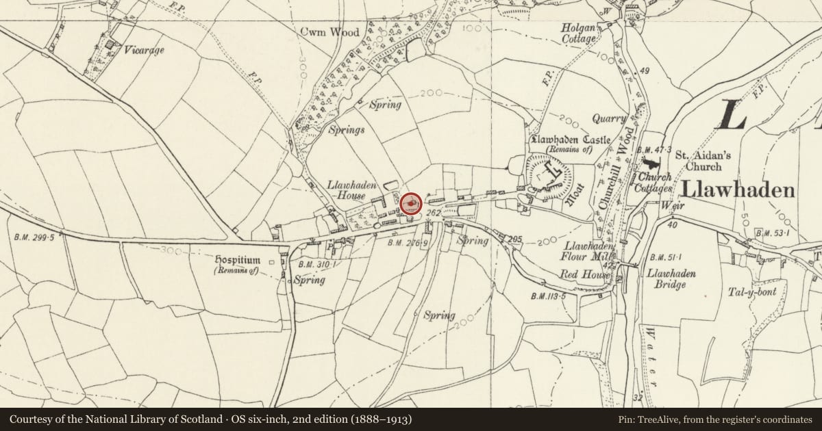
Slide toward Today to fade the historical sheet and see the modern map underneath.
David Rumsey Map Collection, Stanford LibrariesDavid Rumsey Map Collection, Stanford LibrariesDavid Rumsey Map Collection, Stanford LibrariesDavid Rumsey Map Collection, Stanford LibrariesDavid Rumsey Map Collection, Stanford Libraries
5 historical maps cover this location, the earliest the 1636 map "Cornubia : Devonia, Somersetus, Dorcestria, Wiltonia, Glocestria ..." (David Rumsey Map Collection, Stanford Libraries).
Historical maps covering this location
- 1636 · Cornubia : Devonia, Somersetus, Dorcestria, Wiltonia, Glocestria ... (David Rumsey Map Collection, Stanford Libraries)
- 1830 · V.3:11-15:XV. Britisches Reich. A. Kon: England. b. Frstenthum Wales: Shire: 37-40 (David Rumsey Map Collection, Stanford Libraries)
- 1891 · Sheet 10. Ordnance Survey of England and Wales. . (David Rumsey Map Collection, Stanford Libraries)
- 1898 · 228 Haverfordwest (Hills) (David Rumsey Map Collection, Stanford Libraries)
- 1901 · Sheet 13. (David Rumsey Map Collection, Stanford Libraries)
Cadw's description
Location
At the N side of the stable yard which lies to the N of Llawhaden House.
History
A building probably recently built when shown on the Tithe Map of 1839.
Exterior
A building lying E/W at the N side of the stable yard of Llawhaden House, built of hammer-dressed stonework with selected larger stones at the quoins. The S face, towards the house, bears traces of render and whitewash. Slate roof with thin plain barge-boards and tile ridges.
The tall waggon-shed doors are in the W gable, facing toward the farmyard, with a semi-elliptical arch. In the loft storey above there is a casement of domestic type facing W. Two doors in the S wall, one with ventilation slots.
At the E gable there is an animal pen.
Reason for designation
Listed for Group Value with Llawhaden House and as part of a complete mid C19 farmstead.
Nearby in the register
- Stables and Loft at Llawhaden HouseDomesticunder 1 mi
- Llawhaden HouseDomesticunder 1 mi
- Dovecote at Llawhaden HouseAgriculture and Subsistenceunder 1 mi
- Gatepiers and gates at Llawhaden HouseDomesticunder 1 mi
Other entries of the same register within about three miles of this one, by straight line.