Cof Cymru: National Historic Assets of Wales · Wales
Barn at Llawhaden House
Llawhaden, Pembrokeshire, Wales
A Grade II listed building in Llawhaden Village, Llawhaden, Pembrokeshire, designated on 11 August 1997.
The record
- Designation
- Listed building, Grade II
- Broad class
- Agriculture and Subsistence
- Date of designation
- 11 August 1997
- Locality
- Llawhaden Village
- Community
- Llawhaden
- Unitary authority
- Pembrokeshire
- Country
- Wales
- Coordinates
- 51.82165, -4.80246
- Cadw reference
- 18793
Slide toward Today to fade the historical sheet and see the modern map underneath.
David Rumsey Map Collection, Stanford LibrariesDavid Rumsey Map Collection, Stanford LibrariesDavid Rumsey Map Collection, Stanford LibrariesDavid Rumsey Map Collection, Stanford LibrariesDavid Rumsey Map Collection, Stanford Libraries
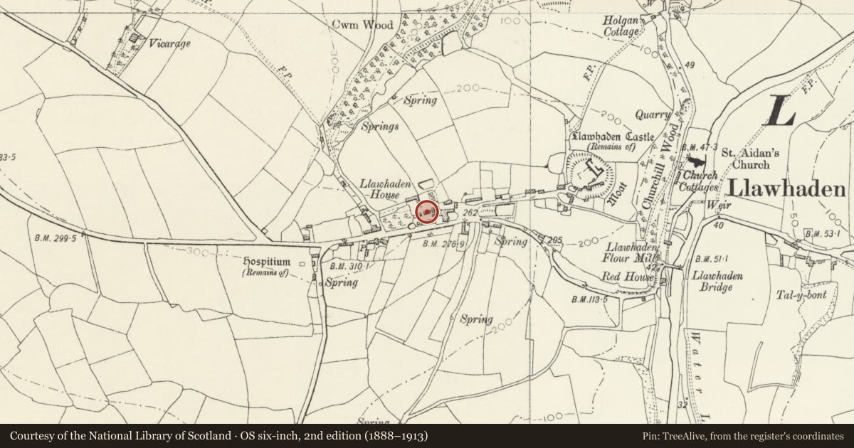
5 historical maps cover this location, the earliest the 1636 map "Cornubia : Devonia, Somersetus, Dorcestria, Wiltonia, Glocestria ..." (David Rumsey Map Collection, Stanford Libraries).
Historical maps covering this location
- 1636 · Cornubia : Devonia, Somersetus, Dorcestria, Wiltonia, Glocestria ... (David Rumsey Map Collection, Stanford Libraries)
- 1830 · V.3:11-15:XV. Britisches Reich. A. Kon: England. b. Frstenthum Wales: Shire: 37-40 (David Rumsey Map Collection, Stanford Libraries)
- 1891 · Sheet 10. Ordnance Survey of England and Wales. . (David Rumsey Map Collection, Stanford Libraries)
- 1898 · 228 Haverfordwest (Hills) (David Rumsey Map Collection, Stanford Libraries)
- 1901 · Sheet 13. (David Rumsey Map Collection, Stanford Libraries)
Cadw's description
Location
In the farmyard of Llawhaden House, about 20 m SW of the dovecote.
History
Not shown on the Tithe Map of 1839, but probably built shortly thereafter. The loft of this barn is probably the place referred to in the Church guide book as used for services during the rebuilding of St Aidan's Church in 1861.
Exterior
A building of rubble masonry, with low-pitched hipped roofs, slated with tile ridges. Tall double doors facing the S with a deep elliptical arch. Three windows in the loft, half glazed and half boarded.There are doors opposite in the N wall (within a later steel-framed lean-to) but much smaller. At the S side, towards the E, are original external stairs to a quarter landing and the loft door. The upper flight of stairs to the loft are internal.
Interior
Roof of common collar-beam trusses, in five bays plus the hipped ends.
Reason for designation
Listed for Group Value with Llawhaden House and as part of a complete mid C19 farmstead.
Nearby in the register
- Milking Shed at Llawhaden HouseAgriculture and Subsistenceunder 1 mi
- Dovecote at Llawhaden HouseAgriculture and Subsistenceunder 1 mi
- Cowhouse Range at Llawhaden HouseAgriculture and Subsistenceunder 1 mi
- Llawhaden HouseDomesticunder 1 mi
Other entries of the same register within about three miles of this one, by straight line.