Cof Cymru: National Historic Assets of Wales · Wales
Dinorben Lodge
Abergele, Conwy, Wales
A Grade II listed building in Dinorben, Abergele, Conwy, designated on 5 August 1997.
The record
- Designation
- Listed building, Grade II
- Broad class
- Domestic
- Date of designation
- 5 August 1997
- Locality
- Dinorben
- Town
- Abergele
- Community
- Abergele
- Unitary authority
- Conwy
- Country
- Wales
- Coordinates
- 53.25850, -3.54513
- Cadw reference
- 18685
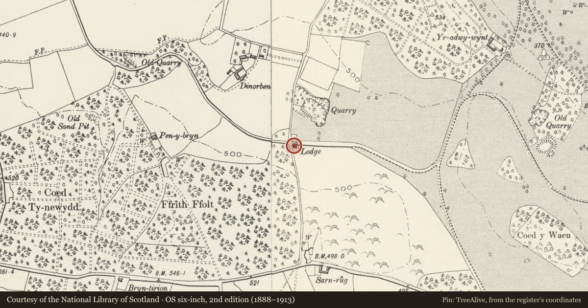
Slide toward Today to fade the historical sheet and see the modern map underneath.
David Rumsey Map Collection, Stanford LibrariesNational Library of ScotlandDavid Rumsey Map Collection, Stanford LibrariesLlyfrgell Genedlaethol Cymru – The National Library of WalesDavid Rumsey Map Collection, Stanford Libraries
5 historical maps cover this location, the earliest the 1795 map "To Sir Watkin Williams-Wynn Bart ... the map of the six counties of North Wales is most humbly inscribed by his obedient humble servant" (Llyfrgell Genedlaethol Cymru – The National Library of Wales).
Historical maps covering this location
- 1795 · To Sir Watkin Williams-Wynn Bart ... the map of the six counties of North Wales is most… (Llyfrgell Genedlaethol Cymru – The National Library of Wales)
- 1830 · V.3:11-15:XV. Britisches Reich. A. Kon: England. b. Frstenthum Wales: Shire: 37-40 (David Rumsey Map Collection, Stanford Libraries)
- 1883 · Watershed map England, Wales 3. (David Rumsey Map Collection, Stanford Libraries)
- 1901 · Sheet 9 and 10. (David Rumsey Map Collection, Stanford Libraries)
- 1963 · Map No. 35 - Local Government Commission for Wales : [Definitive maps showing proposed… (National Library of Scotland)
Cadw's description
Location
The lodge is set on the S side of the W entrance to Kinmel Park, approximately 1300m S of the village of St George.
History
The lodge was built for H R Hughes in 1858.
Exterior
Built of polygonal limestone, with oolite dressings and slate roofs. Single storey, 'Z'-plan, comprising a forward gabled wing on the left (E) facing the drive, having a canted and hipped bay window, and an adjoining gabled porch. Boarded and nailed door in a chamfered reveal, with label over, stepping over a recessed panel with the carved cursive monogram of HRH on a shield. Mullioned and transomed timber windows, probably of the early C20. Carved openwork bargeboards with terminal spikes. The left bay has a part-external gable stack, carrying a stone panel with the date, and a rear gabled service wing.
Reason for designation
Included as a good Victorian park lodge, of special interest as one of the variety of styles of such lodges employed early on on the Kinmel Estate.
Nearby in the register
- Barn at Dinorben HallAgriculture and Subsistenceunder 1 mi
- Dinorben HallDomesticunder 1 mi
- Gates and Gate Piers at the W end of the Broad WalkGardens, Parks and Urban Spacesunder 1 mi
- Gazebo and Summerhouse in Venetian Garden at Kinmel, including attached stepsGardens, Parks and Urban Spacesunder 1 mi
Other entries of the same register within about three miles of this one, by straight line.