Cof Cymru: National Historic Assets of Wales · Wales
The Old Vaults Public House
Rhosddu, Wrexham, Wales
A Grade II listed building in Rhosddu, Wrexham, designated on 31 January 1994.
The record
- Designation
- Listed building, Grade II
- Broad class
- Commercial
- Date of designation
- 31 January 1994
- Community
- Rhosddu
- Unitary authority
- Wrexham
- Country
- Wales
- Coordinates
- 53.04564, -2.99173
- Cadw reference
- 1822
Slide toward Today to fade the historical sheet and see the modern map underneath.
David Rumsey Map Collection, Stanford LibrariesDavid Rumsey Map Collection, Stanford LibrariesDavid Rumsey Map Collection, Stanford LibrariesDavid Rumsey Map Collection, Stanford LibrariesDavid Rumsey Map Collection, Stanford Libraries
5 historical maps cover this location, the earliest the 1608 map "(13) Cambriae Typus." (David Rumsey Map Collection, Stanford Libraries).
Historical maps covering this location
- 1608 · (13) Cambriae Typus. (David Rumsey Map Collection, Stanford Libraries)
- 1883 · Watershed map England, Wales 3. (David Rumsey Map Collection, Stanford Libraries)
- 1898 · 121 Wrexham (Hills) (David Rumsey Map Collection, Stanford Libraries)
- 1898 · 121 Wrexham (Outline) (David Rumsey Map Collection, Stanford Libraries)
- 1901 · Sheet 9 and 10. (David Rumsey Map Collection, Stanford Libraries)
Cadw's description
Location
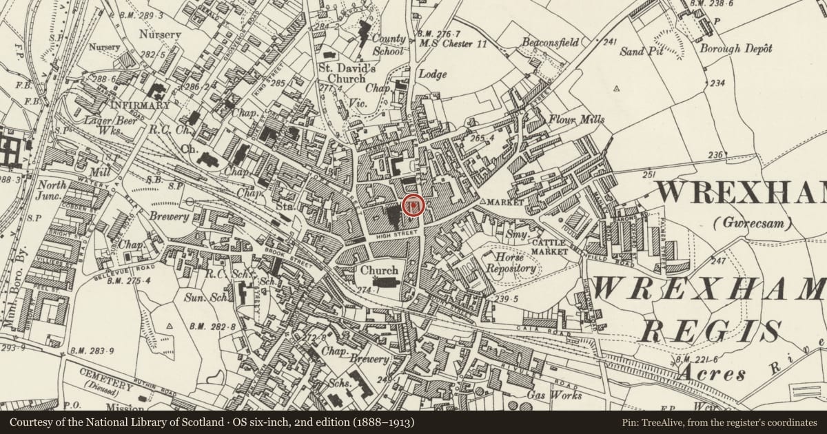
On the corner of Chester Street and Henblas Street.
History
Public House, probably purpose-built as a redevelopment of the site (not shown on the Tithe Map of 1846), c1850-60.
Exterior
Render over brick with dressings stressed through contrasting colour, and hipped slate roof with axial stacks. 3 storeyed, 3-window range to Chester Street, and 2-window return to Henblas Street, together with a single window range extension in the same style, though separately roofed (and possibly representing the refronting of a formerly separate building). Chester Street elevation has central doorway with a further entrance to the left. Both have 4-panelled doors with overlights set in moulded architraves with scrolled brackets to entablature hoods. Wide windows (the glazing renewed) in moulded architraves flank the central entrance. Upper storeys have stressed quoins to angles, and continuous sill bands with moulded brackets. Windows are all set in moulded architraves, and are 4-pane sashes to first floor, and casements with margin lights in upper storey. Paired modillion brackets to eaves cornice. Henblas Street elevation is similarly detailed, and has entrance towards corner with Chester Street, and a separate entrance to rear bar towards the right.
Reason for designation
Listed as a typical example of mid C19 public house architecture which retains much of its original character.
Nearby in the register
- 40 Henblas StreetCommercialunder 1 mi
- General Market Building - Public Convenience (Ladies)Gardens, Parks and Urban Spacesunder 1 mi
- The Feathers Public HouseCommercialunder 1 mi
- Midland BankCommercialunder 1 mi
Other entries of the same register within about three miles of this one, by straight line.