Cof Cymru: National Historic Assets of Wales · Wales
Bridge in Parkland
Tregynon, Powys, Wales
A Grade II listed building in Gregynog, Tregynon, Powys, designated on 31 January 1997.
The record
- Designation
- Listed building, Grade II
- Broad class
- Gardens, Parks and Urban Spaces
- Date of designation
- 31 January 1997
- Locality
- Gregynog
- Community
- Tregynon
- Unitary authority
- Powys
- Country
- Wales
- Coordinates
- 52.56605, -3.35454
- Cadw reference
- 18152
Slide toward Today to fade the historical sheet and see the modern map underneath.
David Rumsey Map Collection, Stanford LibrariesDavid Rumsey Map Collection, Stanford LibrariesLlyfrgell Genedlaethol Cymru – The National Library of WalesDavid Rumsey Map Collection, Stanford LibrariesDavid Rumsey Map Collection, Stanford Libraries
5 historical maps cover this location, the earliest the 1608 map "(13) Cambriae Typus." (David Rumsey Map Collection, Stanford Libraries).
Historical maps covering this location
- 1608 · (13) Cambriae Typus. (David Rumsey Map Collection, Stanford Libraries)
- 1637 · Particular description of Wales. Cambria seu Wallia (David Rumsey Map Collection, Stanford Libraries)
- 1795 · To Sir Watkin Williams-Wynn Bart ... the map of the six counties of North Wales is most… (Llyfrgell Genedlaethol Cymru – The National Library of Wales)
- 1883 · Watershed map England, Wales 3. (David Rumsey Map Collection, Stanford Libraries)
- 1899 · 164 Llanidloes (Hills) (David Rumsey Map Collection, Stanford Libraries)
Cadw's description
Location
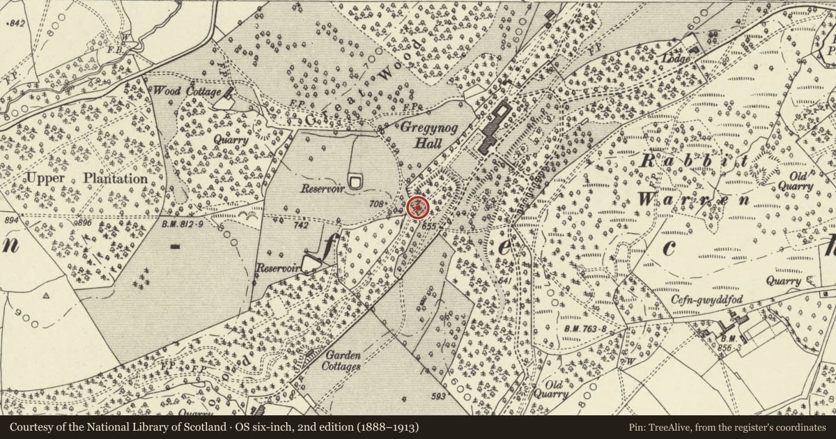
Located approximately 200m SW of Gregynog Hall within a wooded area of parkland and carries a footpath over a drive leading to the W entrance to the grounds of Gregynog Hall.
History
Constructed 1870-1880 by Henry Hanbury-Tracy in unreinforced concrete. Hanbury-Tracy experimented with concrete c1870 and used the material for cottages and farm buildings on the estate. The concrete was made from river gravel, and brick fragments bonded with cement. It was laid in wet courses directly onto the wall using timber shuttering.
Exterior
Single arch bridge of unreinforced concrete with rendered concrete parapet. The walls are built up in a series of lifts in a coarse aggregate and the arch is scribed to imitate ashlar. The parapet has a string course and a moulded cornice with panelled piers at the ends.
Reason for designation
Listed for its pioneering use of unreinforced concrete of which the construction technique is clearly visible, as an important component of the surviving concrete buildings in Tregynon and for group value with other items at Gregynog.
Nearby in the register
- Fountain (south-west)Gardens, Parks and Urban Spacesunder 1 mi
- Fountain (north-east)Gardens, Parks and Urban Spacesunder 1 mi
- Gregynog HallEducationunder 1 mi
- Garden BridgeGardens, Parks and Urban Spacesunder 1 mi
Other entries of the same register within about three miles of this one, by straight line.