Cof Cymru: National Historic Assets of Wales · Wales
Pickhill Bridge
Sesswick, Wrexham, Wales
A Grade II listed building in Pickhill, Sesswick, Wrexham, designated on 20 December 1996.
The record
- Designation
- Listed building, Grade II
- Broad class
- Transport
- Date of designation
- 20 December 1996
- Locality
- Pickhill
- Community
- Sesswick
- Unitary authority
- Wrexham
- Country
- Wales
- Coordinates
- 53.02785, -2.90149
- Cadw reference
- 18059
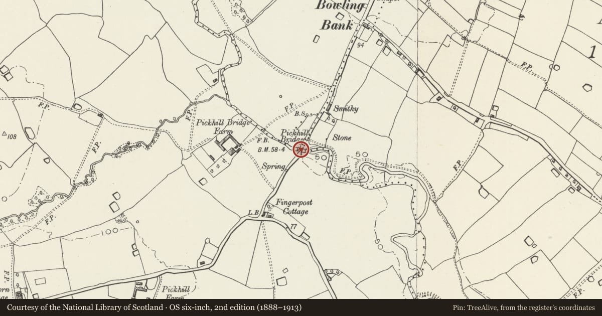
Slide toward Today to fade the historical sheet and see the modern map underneath.
David Rumsey Map Collection, Stanford LibrariesDavid Rumsey Map Collection, Stanford LibrariesDavid Rumsey Map Collection, Stanford LibrariesDavid Rumsey Map Collection, Stanford LibrariesDavid Rumsey Map Collection, Stanford Libraries
5 historical maps cover this location, the earliest the 1608 map "(13) Cambriae Typus." (David Rumsey Map Collection, Stanford Libraries).
Historical maps covering this location
- 1608 · (13) Cambriae Typus. (David Rumsey Map Collection, Stanford Libraries)
- 1861 · 73. Market Drayton. (David Rumsey Map Collection, Stanford Libraries)
- 1883 · Watershed map England, Wales 3. (David Rumsey Map Collection, Stanford Libraries)
- 1897 · 122 Nantwich (Hills) (David Rumsey Map Collection, Stanford Libraries)
- 1901 · Sheet 9 and 10. (David Rumsey Map Collection, Stanford Libraries)
Cadw's description
Location
Pickhill Bridge crosses the River Dee and carries the B5130. The bridge is on the border of Sesswick and Bangor-is-y-Coed Communities lying amongst open farmland on all sides. Pickhill Bridge Farm lies to the west.
History
Records held in the Clwyd County Record Office at Ruthin indicate works carried out on bridges at Pickhill, Sesswick, Bangor, and Bedwell between 1707 and 1818. The current bridge would appear to be late C18/early C19 and all of single construction date, possibly by Thomas Telford who was County Surveyor to Shropshire from 1788. There are said to be the remains of a water mill to the north of the bridge in Mill Wood.
Exterior
Large single-span finely dressed stone road bridge to a symmetrical design with wide copings. Probably late C18/early C19. Parapets splayed at either end in the manner of Telford's canal bridges.
Reason for designation
Listed as a good example of a single-span late C18/early C19 stone bridge.
Nearby in the register
- Pickhill FarmhouseDomesticunder 1 mi
- Pear Tree HouseDomesticunder 1 mi
- Talwrn HouseDomesticunder 1 mi
- Gate and gate-piers at Pickhill Hall LodgeDomesticunder 1 mi
Other entries of the same register within about three miles of this one, by straight line.