Cof Cymru: National Historic Assets of Wales · Wales
Pear Tree House
Isycoed, Wrexham, Wales
A Grade II listed building in Sutton Green, Isycoed, Wrexham, designated on 20 June 1996.
The record
- Designation
- Listed building, Grade II
- Broad class
- Domestic
- Date of designation
- 20 June 1996
- Locality
- Sutton Green
- Community
- Isycoed
- Unitary authority
- Wrexham
- Country
- Wales
- Coordinates
- 53.02690, -2.88964
- Cadw reference
- 17816
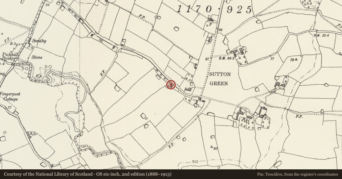
Slide toward Today to fade the historical sheet and see the modern map underneath.
David Rumsey Map Collection, Stanford LibrariesDavid Rumsey Map Collection, Stanford LibrariesDavid Rumsey Map Collection, Stanford LibrariesDavid Rumsey Map Collection, Stanford LibrariesDavid Rumsey Map Collection, Stanford Libraries
5 historical maps cover this location, the earliest the 1608 map "(13) Cambriae Typus." (David Rumsey Map Collection, Stanford Libraries).
Historical maps covering this location
- 1608 · (13) Cambriae Typus. (David Rumsey Map Collection, Stanford Libraries)
- 1861 · 73. Market Drayton. (David Rumsey Map Collection, Stanford Libraries)
- 1883 · Watershed map England, Wales 3. (David Rumsey Map Collection, Stanford Libraries)
- 1897 · 122 Nantwich (Hills) (David Rumsey Map Collection, Stanford Libraries)
- 1901 · Sheet 9 and 10. (David Rumsey Map Collection, Stanford Libraries)
Cadw's description
Location
Set back from the S side of Sun Lane, close to the centre of Sutton Green.
Exterior
History: Probably built mid C19, the house was extended in matching style to provide dairy or workshop facilities. C20 alterations and additions.
Exterior: Brownish-red brick, whitewashed on front elevation, slate roof, rendered chimneys, dentil eaves cornice. 2 storeys. House to left has symmetrical elevation with central entrance with gabled porch flanked by 16-pane sash windows. Upper floor has two 2-light casements. S-shaped tie-plate left hand side. Extension to right has a casement on the upper floor. Right hand return elevation has a split board door and a casement window on upper floor. Rear elevation has rebuilt brick outbuilding to right, off centre entrance with gabled canopy, to left of this a blocked cart opening. S-shaped tie-plates and dentil eaves as on front.
Interior: Refurbished early C20 but plan form is intact. Simple winder stair to rear and under the stairs entrance with stone steps leading down to brick cellar.
Listed as a relatively unaltered mid C19 smallholders house.
Reference: Gresford Tithe Map, 1843
Nearby in the register
- Sutton Green round barrowRound Barrowunder 1 mi
- Pickhill BridgeTransportunder 1 mi
- Gate and gate-piers at Pickhill Hall LodgeDomesticunder 1 mi
- Pickhill HallDomesticunder 1 mi
Other entries of the same register within about three miles of this one, by straight line.