Cof Cymru: National Historic Assets of Wales · Wales
Stafford House
Offa, Wrexham, Wales
A Grade II listed building in Offa, Wrexham, designated on 31 January 1994.
The record
- Designation
- Listed building, Grade II
- Broad class
- Domestic
- Date of designation
- 31 January 1994
- Community
- Offa
- Unitary authority
- Wrexham
- Country
- Wales
- Coordinates
- 53.03998, -2.99663
- Cadw reference
- 1782
Slide toward Today to fade the historical sheet and see the modern map underneath.
David Rumsey Map Collection, Stanford LibrariesDavid Rumsey Map Collection, Stanford LibrariesDavid Rumsey Map Collection, Stanford LibrariesDavid Rumsey Map Collection, Stanford LibrariesDavid Rumsey Map Collection, Stanford Libraries
5 historical maps cover this location, the earliest the 1608 map "(13) Cambriae Typus." (David Rumsey Map Collection, Stanford Libraries).
Historical maps covering this location
- 1608 · (13) Cambriae Typus. (David Rumsey Map Collection, Stanford Libraries)
- 1883 · Watershed map England, Wales 3. (David Rumsey Map Collection, Stanford Libraries)
- 1898 · 121 Wrexham (Hills) (David Rumsey Map Collection, Stanford Libraries)
- 1898 · 121 Wrexham (Outline) (David Rumsey Map Collection, Stanford Libraries)
- 1901 · Sheet 9 and 10. (David Rumsey Map Collection, Stanford Libraries)
Cadw's description
Location
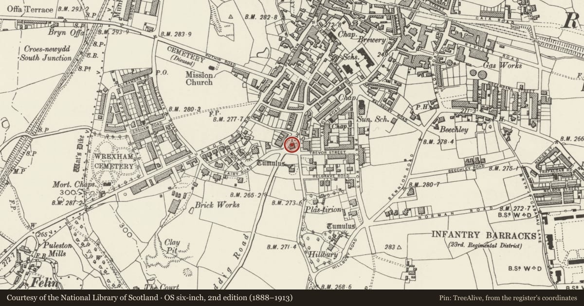
Situated in its own grounds on an 'island' site ringed by Fairy Road, Sontley Road and Erddig Road.
History
House, dated 1876, and probably designed by E. A. Ould for W. E. Samuel, for his own use (his initials appear in a monogramme over the doorway).
Exterior
Brick with stone dressings and half-timbered upper storey. Red plain tiled roof. Arts and Crafts style. 2-storeyed, L-plan. Entrance front faces Fairy Road, and has central entrance porch with 4-centred stone archway, with date and initials on lintel. Canted oriel with steep facetted conical roof jettied out above the entrance. Paired sash windows either side of the doorway, and segmental string course or corbel table below timbered upper storey, which has casement windows either side of central oriel. Return elevation to Erddig Road has expressed stack in gable, with moulded shafts and heavy cap, then rear wing which has higher hipped roof, and houses large mullioned and transomed stair windows, with leaded glazing. Canted angle to rear elevation, which has cat-slide roof against inner angle to garden front. Gabled return of entrance range has canted bay window to ground floor, and casement window in jettied gable above. Gable apex further jettied out. Semi-octagonal turret carried on corbels in inner angle with continuous casement windows with leaded glazing and faceted conical roof.
Reason for designation
A very good example of the Arts and Crafts style, using local materials.
Forms a group with Nos 5-7 and 9 Fairy Road.
Nearby in the register
- 9 Fairy RoadDomesticunder 1 mi
- 7 Fairy RoadDomesticunder 1 mi
- 5 Fairy RoadDomesticunder 1 mi
- Fairy Oak Round BarrowRound Barrowunder 1 mi
Other entries of the same register within about three miles of this one, by straight line.