Cof Cymru: National Historic Assets of Wales · Wales
St. Giles' Churchyard Gates
Offa, Wrexham, Wales
A Grade II* listed building in Offa, Wrexham, designated on 30 May 1951.
The record
- Designation
- Listed building, Grade II*
- Broad class
- Religious, Ritual and Funerary
- Date of designation
- 30 May 1951
- Community
- Offa
- Unitary authority
- Wrexham
- Country
- Wales
- Coordinates
- 53.04463, -2.99292
- Cadw reference
- 1774
Slide toward Today to fade the historical sheet and see the modern map underneath.
David Rumsey Map Collection, Stanford LibrariesDavid Rumsey Map Collection, Stanford LibrariesDavid Rumsey Map Collection, Stanford LibrariesDavid Rumsey Map Collection, Stanford LibrariesDavid Rumsey Map Collection, Stanford Libraries
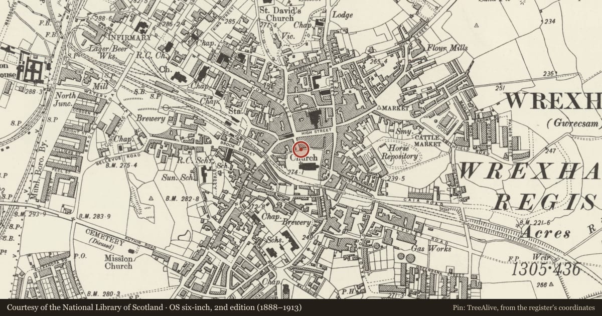
5 historical maps cover this location, the earliest the 1608 map "(13) Cambriae Typus." (David Rumsey Map Collection, Stanford Libraries).
Historical maps covering this location
- 1608 · (13) Cambriae Typus. (David Rumsey Map Collection, Stanford Libraries)
- 1883 · Watershed map England, Wales 3. (David Rumsey Map Collection, Stanford Libraries)
- 1898 · 121 Wrexham (Hills) (David Rumsey Map Collection, Stanford Libraries)
- 1898 · 121 Wrexham (Outline) (David Rumsey Map Collection, Stanford Libraries)
- 1901 · Sheet 9 and 10. (David Rumsey Map Collection, Stanford Libraries)
Cadw's description
Location
Main entrance gates to churchyard, on principal alignment of NW door to church and Church Street, with side arches over College Row and Temple Row.
History
Churchyard gates. Erected in 1720, by the Davies brothers of Bersham, and restored in c1820 and 1900. The gates were slightly moved from their original position some time after 1821.
Exterior
Wrought iron. Central arched double gates with flanking side gates of less height, also arched, with hollow square section wrought iron piers each side of main and side gates; which are all highly enriched, and have scrolled overthrows incorporating sprays of leaves and flowers. Outer rusticated stone piers, surmounted by urn finials, then quadrants with overthrows in a similar style straddling College and Temple Rows, apparently added in 1821. Plain cast iron railings carried on low plinth wall enclose the churchyard to north and east, set up 1807-1808.
Nearby in the register
- Wrexham Churchyard Ornamental Wrought Iron Gates and ScreenGateunder 1 mi
- 4 Church StreetDomesticunder 1 mi
- 3 Church StreetDomesticunder 1 mi
- 6 Temple RowDomesticunder 1 mi
Other entries of the same register within about three miles of this one, by straight line.