Cof Cymru: National Historic Assets of Wales · Wales
Llanarth Villa
Llanarth, Ceredigion, Wales
A Grade II listed building in Llanarth, Ceredigion, designated on 16 February 1996.
The record
- Designation
- Listed building, Grade II
- Broad class
- Domestic
- Date of designation
- 16 February 1996
- Locality
- Llanarth
- Community
- Llanarth
- Unitary authority
- Ceredigion
- Country
- Wales
- Coordinates
- 52.19318, -4.31141
- Cadw reference
- 17724
Slide toward Today to fade the historical sheet and see the modern map underneath.
David Rumsey Map Collection, Stanford LibrariesDavid Rumsey Map Collection, Stanford LibrariesDavid Rumsey Map Collection, Stanford LibrariesDavid Rumsey Map Collection, Stanford LibrariesDavid Rumsey Map Collection, Stanford Libraries
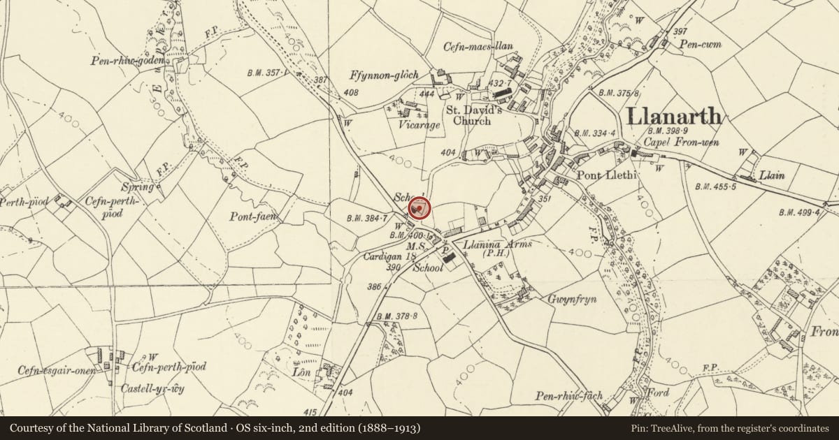
5 historical maps cover this location, the earliest the 1608 map "(13) Cambriae Typus." (David Rumsey Map Collection, Stanford Libraries).
Historical maps covering this location
- 1608 · (13) Cambriae Typus. (David Rumsey Map Collection, Stanford Libraries)
- 1830 · V.3:11-15:XV. Britisches Reich. A. Kon: England. b. Frstenthum Wales: Shire: 37-40 (David Rumsey Map Collection, Stanford Libraries)
- 1899 · 194 Llangranog (Hills) (David Rumsey Map Collection, Stanford Libraries)
- 1901 · Sheet 14. (David Rumsey Map Collection, Stanford Libraries)
- 1919 · Sheet 78. Lampeter. (David Rumsey Map Collection, Stanford Libraries)
Cadw's description
Location
Situated just NE of former National School, at beginning of lane from B4342 New Quay road up to parish church.
History
1859-60 former teacher's house for Llanarth and Llanina National School, by R.J. Withers.
Exterior
Coursed grey rubble stone thinly banded in red brick with slate half-hipped roof and crested ridge tiles. Attractive sandstone squat ridge stack with battered base and half-round ashlar flue dividers. Battered rear wall tall chimney. One and a half storeys, double fronted. High Victorian Gothic style. 16-pane sashes to ground floor with chamfered ashlar surrounds, ashlar lintels and flush sills. Pointed stone relieving arches. Centre door has shouldered head to ashlar surround and similar relieving arch, the ledged door with strap hinges recessed within. Red brick bands at sill and springing level of relieving arches. Front has subtly asymmetrically-placed upper window, 9-pane sash with similar ashlar surround but no relieving arch, the head breaking eaves under stone gable with small vent loop.
Left end wall has window each floor with relieving arch, but C20 glazing replaces sashes. Right end has first floor 16-pane sash with relieving arch.
Rear right has C20 cement block 2-storey addition, rear left outshut roof.
Reason for designation
Part of a very good High Victorian Gothic school group in the simplified style pioneered by G.E. Street and William Butterfield in the late 1850s. The school has been altered but the house still retains most of the original features.
Nearby in the register
- Former National SchoolEducationunder 1 mi
- Milestone outside SchoolTransportunder 1 mi
- AuroraDomesticunder 1 mi
- HafanDomesticunder 1 mi
Other entries of the same register within about three miles of this one, by straight line.