Cof Cymru: National Historic Assets of Wales · Wales
Stone Chimney at Pentre Saeson Foundry
Brymbo, Wrexham, Wales
A Grade II listed building in Pentre Saeson, Brymbo, Wrexham, designated on 9 October 1978.
The record
- Designation
- Listed building, Grade II
- Broad class
- Industrial
- Date of designation
- 9 October 1978
- Locality
- Pentre Saeson
- Community
- Brymbo
- Unitary authority
- Wrexham
- Country
- Wales
- Coordinates
- 53.07097, -3.07818
- Cadw reference
- 1717
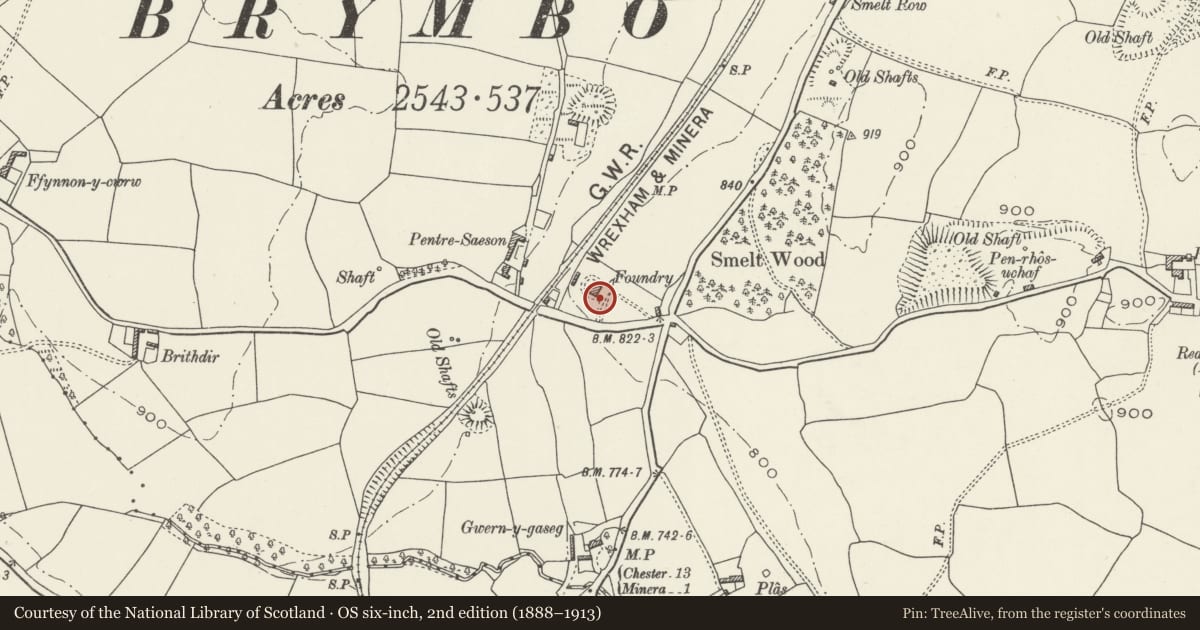
Slide toward Today to fade the historical sheet and see the modern map underneath.
David Rumsey Map Collection, Stanford LibrariesDavid Rumsey Map Collection, Stanford LibrariesDavid Rumsey Map Collection, Stanford LibrariesLlyfrgell Genedlaethol Cymru – The National Library of WalesDavid Rumsey Map Collection, Stanford Libraries
5 historical maps cover this location, the earliest the 1608 map "(13) Cambriae Typus." (David Rumsey Map Collection, Stanford Libraries).
Historical maps covering this location
- 1608 · (13) Cambriae Typus. (David Rumsey Map Collection, Stanford Libraries)
- 1795 · To Sir Watkin Williams-Wynn Bart ... the map of the six counties of North Wales is most… (Llyfrgell Genedlaethol Cymru – The National Library of Wales)
- 1883 · Watershed map England, Wales 3. (David Rumsey Map Collection, Stanford Libraries)
- 1898 · 121 Wrexham (Hills) (David Rumsey Map Collection, Stanford Libraries)
- 1901 · Sheet 9 and 10. (David Rumsey Map Collection, Stanford Libraries)
Cadw's description
Location
Close to the B5102, between Brymbo and Bwlchgwyn.
History
The foundry was probably established in the late C18 by John Wilkinson, and the chimney is likely to be largely an original feature.
Exterior
Tall circular chimney of stone rubble laid in large blocks, with capping; upper stage above capping is brick. Two semi-circular headed openings with brick dressings on opposite sides at ground level.
Reason for designation
An integral part of the very rare surviving small foundry complex at Pentre Saeson.
Nearby in the register
- Pentre Saeson Foundry BuildingIndustrialunder 1 mi
- Pen-Rhos Engine HouseIndustrialunder 1 mi
- Penrhos Engine HouseEngine Houseunder 1 mi
- The Bottle ChimneyIndustrialunder 1 mi
Other entries of the same register within about three miles of this one, by straight line.