Cof Cymru: National Historic Assets of Wales · Wales
Church Cottage
Overton, Wrexham, Wales
A Grade II listed building in Overton, Wrexham, designated on 16 November 1962.
The record
- Designation
- Listed building, Grade II
- Broad class
- Commercial
- Date of designation
- 16 November 1962
- Community
- Overton
- Unitary authority
- Wrexham
- Country
- Wales
- Coordinates
- 52.97039, -2.93491
- Cadw reference
- 1684
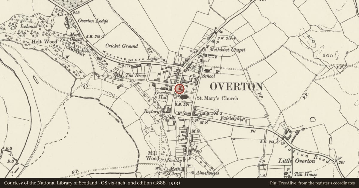
Slide toward Today to fade the historical sheet and see the modern map underneath.
David Rumsey Map Collection, Stanford LibrariesDavid Rumsey Map Collection, Stanford LibrariesDavid Rumsey Map Collection, Stanford LibrariesDavid Rumsey Map Collection, Stanford LibrariesDavid Rumsey Map Collection, Stanford Libraries
5 historical maps cover this location, the earliest the 1608 map "(13) Cambriae Typus." (David Rumsey Map Collection, Stanford Libraries).
Historical maps covering this location
- 1608 · (13) Cambriae Typus. (David Rumsey Map Collection, Stanford Libraries)
- 1637 · Particular description of Wales. Cambria seu Wallia (David Rumsey Map Collection, Stanford Libraries)
- 1830 · V.3:11-15:XV.Britisches Reich. A. Kon: England. a. England ab sich: Shire:15-17, 33 (David Rumsey Map Collection, Stanford Libraries)
- 1883 · Watershed map England, Wales 3. (David Rumsey Map Collection, Stanford Libraries)
- 1901 · Sheet 9 and 10. (David Rumsey Map Collection, Stanford Libraries)
Cadw's description
Location
Alongside the churchyard, at the end of a row of commercial buildings and houses.
History
Small cottage. Probably in origin C16 or early C17, but with some structural modifications. Apparently used as a shop at one time.
Exterior
Timber framed and painted brick with plain-tiled roof laid with scalloped bands. Originally square-panelled framing, but gable wall and part of front wall have been renewed in brick, painted in imitation of framing, probably in the C19. Single storeyed with an attic lit from the apex of the gable. Small 2-unit plan, with doorway towards centre, flanked by a 2-light casement window to right, and fixed-light 9-pane window to the right. Added lean-to to left is painted brick with 6-pane sash window: its position to the left of the stack suggests that the entire left-hand bay behind the lean-to may be a later addition, perhaps filling in a passage. It may have served as a small shop.
Reason for designation
A good example of a small vernacular building of the C17, retaining its scale and plan in spite of a number of alterations to the structure. Part of an important group of buildings on High Street.
Nearby in the register
- 17 High StreetCommercialunder 1 mi
- 18 High StreetCommercialunder 1 mi
- Telephone Call-boxCommunicationsunder 1 mi
- White CottageDomesticunder 1 mi
Other entries of the same register within about three miles of this one, by straight line.