Cof Cymru: National Historic Assets of Wales · Wales
Pont-y-Mwynwr
Llanferres, Denbighshire, Wales
A Grade II listed building in Maeshafen, Llanferres, Denbighshire, designated on 16 October 1995.
The record
- Designation
- Listed building, Grade II
- Broad class
- Domestic
- Date of designation
- 16 October 1995
- Locality
- Maeshafen
- Community
- Llanferres
- Unitary authority
- Denbighshire
- Country
- Wales
- Coordinates
- 53.14088, -3.20801
- Cadw reference
- 16446
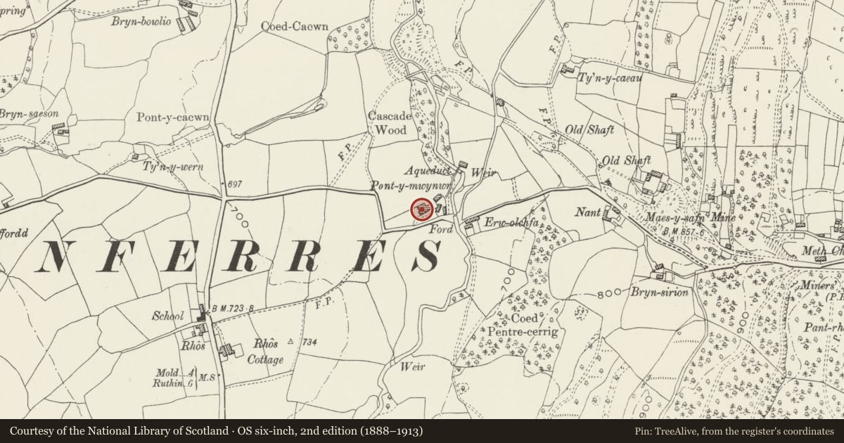
Slide toward Today to fade the historical sheet and see the modern map underneath.
David Rumsey Map Collection, Stanford LibrariesDavid Rumsey Map Collection, Stanford LibrariesDavid Rumsey Map Collection, Stanford LibrariesDavid Rumsey Map Collection, Stanford LibrariesLlyfrgell Genedlaethol Cymru – The National Library of Wales
5 historical maps cover this location, the earliest the 1795 map "To Sir Watkin Williams-Wynn Bart ... the map of the six counties of North Wales is most humbly inscribed by his obedient humble servant" (Llyfrgell Genedlaethol Cymru – The National Library of Wales).
Historical maps covering this location
- 1795 · To Sir Watkin Williams-Wynn Bart ... the map of the six counties of North Wales is most… (Llyfrgell Genedlaethol Cymru – The National Library of Wales)
- 1883 · Watershed map England, Wales 3. (David Rumsey Map Collection, Stanford Libraries)
- 1898 · 108 Flint (Hills) (David Rumsey Map Collection, Stanford Libraries)
- 1898 · 108 Flint (Outline) (David Rumsey Map Collection, Stanford Libraries)
- 1901 · Sheet 9 and 10. (David Rumsey Map Collection, Stanford Libraries)
Cadw's description
Location
Situated 0.9 km W of Maeshafn close to a bridge over the River Alyn, set back off the road. Reached along a by road E off A494 towards Maeshafn; NE of Llanferres.
History
Built as a mine agents house, probably early C19 following the reopening of the mine in 1823.
Exterior
Tudor Gothic Revival style with good detailing. Ashlar, slate roof. 2-storey 4-bay with two projecting gabled bays that to left battered, that to centre a storeyed porch bay. To left of this a later C19 bay window. Windows have stilted hoodmoulds and are generally 12 and 16-pane sashes. Pointed arched entrance with hood mould. Painted rendered left hand return elevation, some rear elements have slate hanging.
Interior
Stair with open string of early C19 appearance, Ruabon tiled floor of late C19.
Full inspection not possible at time of 1995 survey.
Reason for designation
Listed as a good example of an early C19 house and for association with the local mining industry.
Nearby in the register
- Bridge at Cascade WoodTransportunder 1 mi
- Nant CottageDomesticunder 1 mi
- Former Stable Range at Tyn Llan FarmDomesticunder 1 mi
- Tyn Llan FarmhouseDomesticunder 1 mi
Other entries of the same register within about three miles of this one, by straight line.