Cof Cymru: National Historic Assets of Wales · Wales
Bridge at Cascade Wood
Llanferres, Denbighshire, Wales
A Grade II listed building in Tafarn-y-Gelyn, Llanferres, Denbighshire, designated on 16 October 1995.
The record
- Designation
- Listed building, Grade II
- Broad class
- Transport
- Date of designation
- 16 October 1995
- Locality
- Tafarn-y-Gelyn
- Community
- Llanferres
- Unitary authority
- Denbighshire
- Country
- Wales
- Coordinates
- 53.14335, -3.20825
- Cadw reference
- 16448
Slide toward Today to fade the historical sheet and see the modern map underneath.
David Rumsey Map Collection, Stanford LibrariesDavid Rumsey Map Collection, Stanford LibrariesDavid Rumsey Map Collection, Stanford LibrariesDavid Rumsey Map Collection, Stanford LibrariesLlyfrgell Genedlaethol Cymru – The National Library of Wales
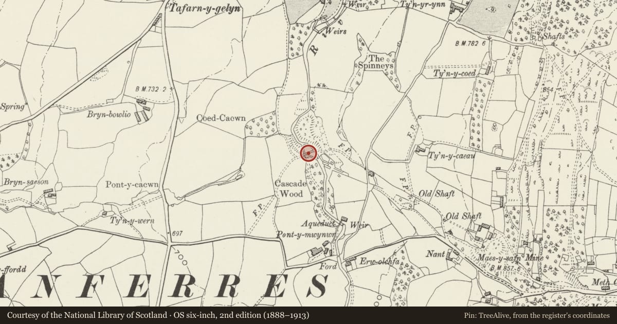
5 historical maps cover this location, the earliest the 1795 map "To Sir Watkin Williams-Wynn Bart ... the map of the six counties of North Wales is most humbly inscribed by his obedient humble servant" (Llyfrgell Genedlaethol Cymru – The National Library of Wales).
Historical maps covering this location
- 1795 · To Sir Watkin Williams-Wynn Bart ... the map of the six counties of North Wales is most… (Llyfrgell Genedlaethol Cymru – The National Library of Wales)
- 1883 · Watershed map England, Wales 3. (David Rumsey Map Collection, Stanford Libraries)
- 1898 · 108 Flint (Hills) (David Rumsey Map Collection, Stanford Libraries)
- 1898 · 108 Flint (Outline) (David Rumsey Map Collection, Stanford Libraries)
- 1901 · Sheet 9 and 10. (David Rumsey Map Collection, Stanford Libraries)
Cadw's description
Location
Set in the heart of Cascade Wood south east of Tafarn-y-Gelyn and west of Maeshafn. Spanning the River Alyn and reached from a woodland footpath off a lane to the east of the river.
History
Built for the Maeshafn Lead Mine probably to carry a works railway or a tramroad. The mine was first opened in 1755, closed in 1799 and then reopened in 1823, after which time the bridge was built. The mine’s most successful period was between 1840 and 1865. The site ran east from the bridge towards Maeshafn.
Exterior
Early to mid C19 stone bridge of causeway type with two broadly spaced arches spanning the two diverged channels of the River Alyn at this point. Rubble construction with dressed stone voussoirs and keystones to semicircular arches. Single-carriageway deck, now used as a footbridge; no parapets.
Reason for designation
Included for its special interest as a surviving earlier C19 structure associated with the lead industry in this region.
Nearby in the register
- Pont-y-MwynwrDomesticunder 1 mi
- Glan-y-AfonDomesticunder 1 mi
- Nant CottageDomesticunder 1 mi
- Telephone Call-box beside Ty Capel, 1494 (W side), Tafarn-y-gelynCommunicationsunder 1 mi
Other entries of the same register within about three miles of this one, by straight line.