Cof Cymru: National Historic Assets of Wales · Wales
Tyn Llan Farmhouse
Llanferres, Denbighshire, Wales
A Grade II listed building in Llanferres, Denbighshire, designated on 26 April 1990.
The record
- Designation
- Listed building, Grade II
- Broad class
- Domestic
- Date of designation
- 26 April 1990
- Locality
- Llanferres
- Community
- Llanferres
- Unitary authority
- Denbighshire
- Country
- Wales
- Coordinates
- 53.13627, -3.21414
- Cadw reference
- 1326
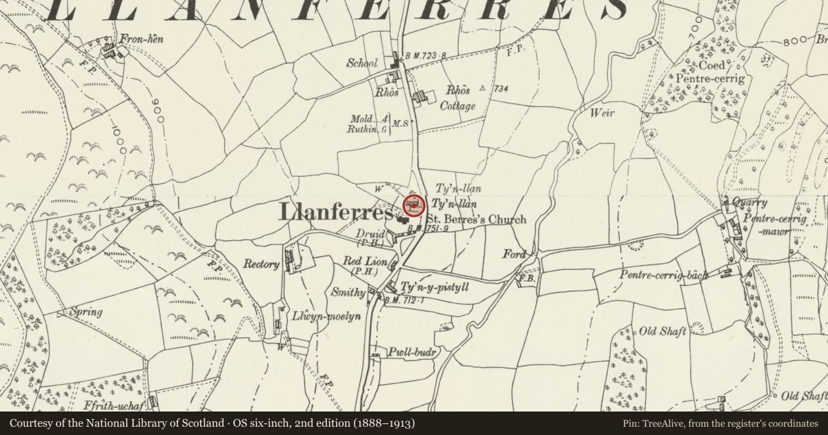
Slide toward Today to fade the historical sheet and see the modern map underneath.
David Rumsey Map Collection, Stanford LibrariesDavid Rumsey Map Collection, Stanford LibrariesDavid Rumsey Map Collection, Stanford LibrariesDavid Rumsey Map Collection, Stanford LibrariesLlyfrgell Genedlaethol Cymru – The National Library of Wales
5 historical maps cover this location, the earliest the 1795 map "To Sir Watkin Williams-Wynn Bart ... the map of the six counties of North Wales is most humbly inscribed by his obedient humble servant" (Llyfrgell Genedlaethol Cymru – The National Library of Wales).
Historical maps covering this location
- 1795 · To Sir Watkin Williams-Wynn Bart ... the map of the six counties of North Wales is most… (Llyfrgell Genedlaethol Cymru – The National Library of Wales)
- 1883 · Watershed map England, Wales 3. (David Rumsey Map Collection, Stanford Libraries)
- 1898 · 108 Flint (Hills) (David Rumsey Map Collection, Stanford Libraries)
- 1898 · 108 Flint (Outline) (David Rumsey Map Collection, Stanford Libraries)
- 1901 · Sheet 9 and 10. (David Rumsey Map Collection, Stanford Libraries)
Cadw's description
Location
At right angles to the road, immediately to the N of the parish church.
History
Late C18, this was probably the rectory house which was acquired and altered in 1813.
Exterior
Roughly coursed and squared rubble with brick arches to some windows, slate roof and red brick end chimney stacks. Symmetrical 2-window elevation to churchyard with later C19 12- and 16-pane horned sash windows. Added gabled porch with side entrance and 9-pane sash window to front. Single storey extension to left. Rear elevation has C20 lean-to porch, C20 glazing.
Interior
The house was being renovated at time of 1990 inspection when it contained 2 large cambered arched fireplaces and brick walls. Not accessible at time of 1995 survey.
Reason for designation
Group value with other listed buildings of Tyn Llan Farm, with the parish church and churchyard gatepiers.
Listed for its importance as part of the historic core of the village.
Nearby in the register
- Former Barn at Tyn Llan FarmAgriculture and Subsistenceunder 1 mi
- Former Stable Range at Tyn Llan FarmDomesticunder 1 mi
- Gatepiers to St Berres ChurchReligious, Ritual and Funeraryunder 1 mi
- Parish Church of St BerresReligious, Ritual and Funeraryunder 1 mi
Other entries of the same register within about three miles of this one, by straight line.