Cof Cymru: National Historic Assets of Wales · Wales
Barn Range ar Pennarth-Ganol
Cynwyl Gaeo, Carmarthenshire, Wales
A Grade II listed building in Pumpsaint, Cynwyl Gaeo, Carmarthenshire, designated on 2 August 1995.
The record
- Designation
- Listed building, Grade II
- Broad class
- Agriculture and Subsistence
- Date of designation
- 2 August 1995
- Locality
- Pumpsaint
- Community
- Cynwyl Gaeo
- Unitary authority
- Carmarthenshire
- Country
- Wales
- Coordinates
- 52.04256, -3.97213
- Cadw reference
- 16264
Slide toward Today to fade the historical sheet and see the modern map underneath.
David Rumsey Map Collection, Stanford LibrariesDavid Rumsey Map Collection, Stanford LibrariesDavid Rumsey Map Collection, Stanford LibrariesDavid Rumsey Map Collection, Stanford LibrariesDavid Rumsey Map Collection, Stanford Libraries
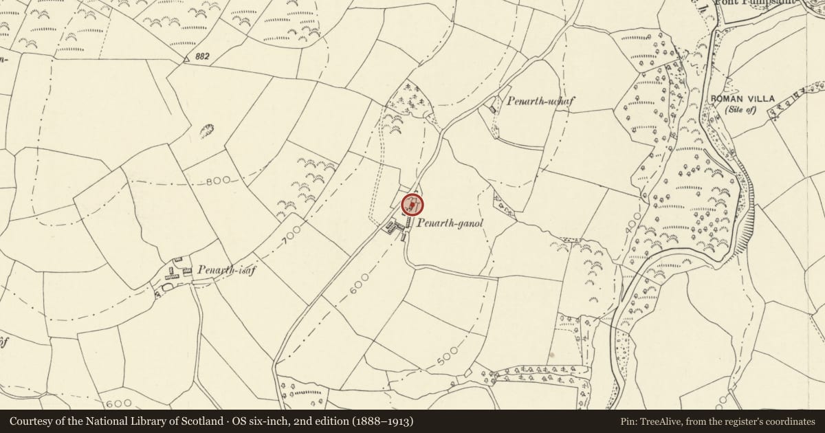
5 historical maps cover this location, the earliest the 1860 map "41. Caermathen." (David Rumsey Map Collection, Stanford Libraries).
Historical maps covering this location
- 1860 · 41. Caermathen. (David Rumsey Map Collection, Stanford Libraries)
- 1891 · Sheet 10. Ordnance Survey of England and Wales. . (David Rumsey Map Collection, Stanford Libraries)
- 1898 · 212 Llandovery (Outline) (David Rumsey Map Collection, Stanford Libraries)
- 1898 · 212 Llandovery (Hills) (David Rumsey Map Collection, Stanford Libraries)
- 1901 · Sheet 14. (David Rumsey Map Collection, Stanford Libraries)
Cadw's description
Location
Farm situated alongside by-road leading from Pumpsaint towards Llansawel. Barn located immediately N of farmhouse, away from farmyard.
History
Mid/late C19 barn range. Farm owned in 1841 by Sir James Williams of Edwinsford and occupied by James Thomas. Barn occupies unusual site across steep slope and consequently has no rear exit.
Exterior
Whitewashed rubble construction. Slate roof and slated barges. Cart doorway to right, cambered stone voussoired head, paired corrugated-iron doors. Two-light window above rising to soffit, stone sill. High barn door to left, similar head, paired planked door with dividing-post. Long loop each side of door, that to left partly obscured by a small corrugated-iron lean-to.
Stone steps to loft door at right end, boarded door; concrete lintel. Rubble rear with high plinth across steep slope. Two ground floor windows, cambered stone voussoired heads, upper window to left rising to eaves.
Interior
Collarbeam roof. Loft over cart-house.
Reason for designation
Good unspoilt and unusual mid/late C19 barn range. Group value with house.
Nearby in the register
- Penarth-GanolDomesticunder 1 mi
- The Dolaucothi ArmsCommercialunder 1 mi
- War Memorial Gates and Railings to the Village HallCommemorativeunder 1 mi
- Former Carthouse and Stable opposite Dolaucothi ArmsDomesticunder 1 mi
Other entries of the same register within about three miles of this one, by straight line.