Cof Cymru: National Historic Assets of Wales · Wales
Former Carthouse and Stable opposite Dolaucothi Arms
Cynwyl Gaeo, Carmarthenshire, Wales
A Grade II listed building in Pumpsaint, Cynwyl Gaeo, Carmarthenshire, designated on 14 January 1988.
The record
- Designation
- Listed building, Grade II
- Broad class
- Domestic
- Date of designation
- 14 January 1988
- Locality
- Pumpsaint
- Community
- Cynwyl Gaeo
- Unitary authority
- Carmarthenshire
- Country
- Wales
- Coordinates
- 52.04717, -3.96081
- Cadw reference
- 11133
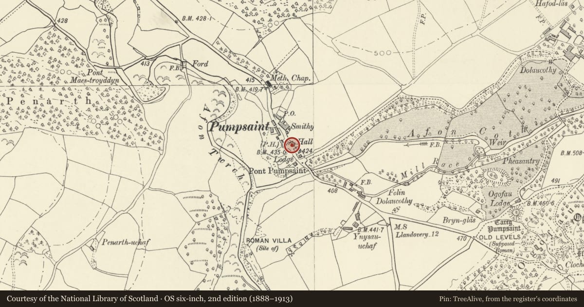
Slide toward Today to fade the historical sheet and see the modern map underneath.
David Rumsey Map Collection, Stanford LibrariesDavid Rumsey Map Collection, Stanford LibrariesDavid Rumsey Map Collection, Stanford LibrariesDavid Rumsey Map Collection, Stanford LibrariesDavid Rumsey Map Collection, Stanford Libraries
5 historical maps cover this location, the earliest the 1608 map "(13) Cambriae Typus." (David Rumsey Map Collection, Stanford Libraries).
Historical maps covering this location
- 1608 · (13) Cambriae Typus. (David Rumsey Map Collection, Stanford Libraries)
- 1830 · V.3:11-15:XV. Britisches Reich. A. Kon: England. b. Frstenthum Wales: Shire: 37-40 (David Rumsey Map Collection, Stanford Libraries)
- 1860 · 41. Caermathen. (David Rumsey Map Collection, Stanford Libraries)
- 1891 · Sheet 10. Ordnance Survey of England and Wales. . (David Rumsey Map Collection, Stanford Libraries)
- 1901 · Sheet 14. (David Rumsey Map Collection, Stanford Libraries)
Cadw's description
Location
Located in village centre on N side of A482 opposite the Dolaucothi Arms Hotel.
History
Built 1833, former stables of the Dolaucothi Arms. Owner in 1841 was John Johnes of Dolaucothi.
Exterior
Rubble built, squared quoins. Slate roof, slated barges. Two-storey symmetrical facade. Three upper 16-pane 2- light casements, cambered stone voussoired heads, slate sills. Central pair of round-arched cart doors to ground floor, stone voussoirs, central pier of dressed stone. Planked double doors, strap hinges. Semicircular window each side, stone voussoirs, simple tripartite vertical glazing. Datestone below central window.
Right gable end with ground floor doorway, cambered stone voussoired head, divided stable-type planked door. Blocked door above offset to right, similar head. Left end with ground floor doorway, C20 planked door, head as above. Flight of cemented stone steps to planked loft door, head as above. Semi-circular stone vaulted recess under stair. Later miscellaneous farm buildings to rear, upper door rising to eaves, C20 door.
Reason for designation
Prominent early C19 former estate building with carefully proportioned stonework detailing. Attractive village setting.
Nearby in the register
- Pumpsaint Roman FortFortunder 1 mi
- Village HallRecreationalunder 1 mi
- War Memorial Gates and Railings to the Village HallCommemorativeunder 1 mi
- The Dolaucothi ArmsCommercialunder 1 mi
Other entries of the same register within about three miles of this one, by straight line.