Cof Cymru: National Historic Assets of Wales · Wales
Barn Range at Glanyrannell
Cynwyl Gaeo, Carmarthenshire, Wales
A Grade II listed building in Caeo, Cynwyl Gaeo, Carmarthenshire, designated on 2 August 1995.
The record
- Designation
- Listed building, Grade II
- Broad class
- Agriculture and Subsistence
- Date of designation
- 2 August 1995
- Locality
- Caeo
- Community
- Cynwyl Gaeo
- Unitary authority
- Carmarthenshire
- Country
- Wales
- Coordinates
- 52.03553, -3.93687
- Cadw reference
- 16234
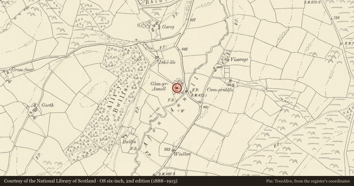
Slide toward Today to fade the historical sheet and see the modern map underneath.
David Rumsey Map Collection, Stanford LibrariesDavid Rumsey Map Collection, Stanford LibrariesDavid Rumsey Map Collection, Stanford LibrariesDavid Rumsey Map Collection, Stanford LibrariesDavid Rumsey Map Collection, Stanford Libraries
5 historical maps cover this location, the earliest the 1860 map "41. Caermathen." (David Rumsey Map Collection, Stanford Libraries).
Historical maps covering this location
- 1860 · 41. Caermathen. (David Rumsey Map Collection, Stanford Libraries)
- 1891 · Sheet 10. Ordnance Survey of England and Wales. . (David Rumsey Map Collection, Stanford Libraries)
- 1898 · 212 Llandovery (Hills) (David Rumsey Map Collection, Stanford Libraries)
- 1898 · 212 Llandovery (Outline) (David Rumsey Map Collection, Stanford Libraries)
- 1901 · Sheet 14. (David Rumsey Map Collection, Stanford Libraries)
Cadw's description
Location
Farm situated alongside by-road between Cynwyl Gaeo and Crugybar. Farmyard in front of house with barn along S side.
History
Mid C19. Different arrangement of farm buildings shown on 1841 Tithe map. The farmstead was rebuilt c1845 by the Dolaucothi estate, who were redeveloping much of their property at this time.
Exterior
Rubble-built. Slate roof and slated barges. High renewed planked door to left; concrete lintel. Long loop each side. Pair of cart-entries to right; elliptical heads with stone voussoirs; paired planked doors. Right end with stone steps to boarded loft door, cambered stone voussoired head. Left gable with loop.
Rear with later rubble lean-to on left incorporating a double W.C at left end. C20 corrugated-iron shed to right, obscuring low barn door with cambered stone voussoired head and paired planked doors: loop each side.
Interior
Collar-beam roof. Loft over cart-house.
Reason for designation
Group value with farmhouse.
Nearby in the register
- GlanyrannellDomesticunder 1 mi
- Cowshed at GlanyrannellAgriculture and Subsistenceunder 1 mi
- Cooling House at GlanyrannellIndustrialunder 1 mi
- Former Agricultural Rnge to south-west of DyffrynAgriculture and Subsistenceunder 1 mi
Other entries of the same register within about three miles of this one, by straight line.