Cof Cymru: National Historic Assets of Wales · Wales
Farm Building Range at the Firs
Bausley with Criggion, Powys, Wales
A Grade II listed building in Bausley with Criggion, Powys, designated on 29 December 1994.
The record
- Designation
- Listed building, Grade II
- Broad class
- Agriculture and Subsistence
- Date of designation
- 29 December 1994
- Community
- Bausley with Criggion
- Unitary authority
- Powys
- Country
- Wales
- Coordinates
- 52.73347, -3.00366
- Cadw reference
- 15445
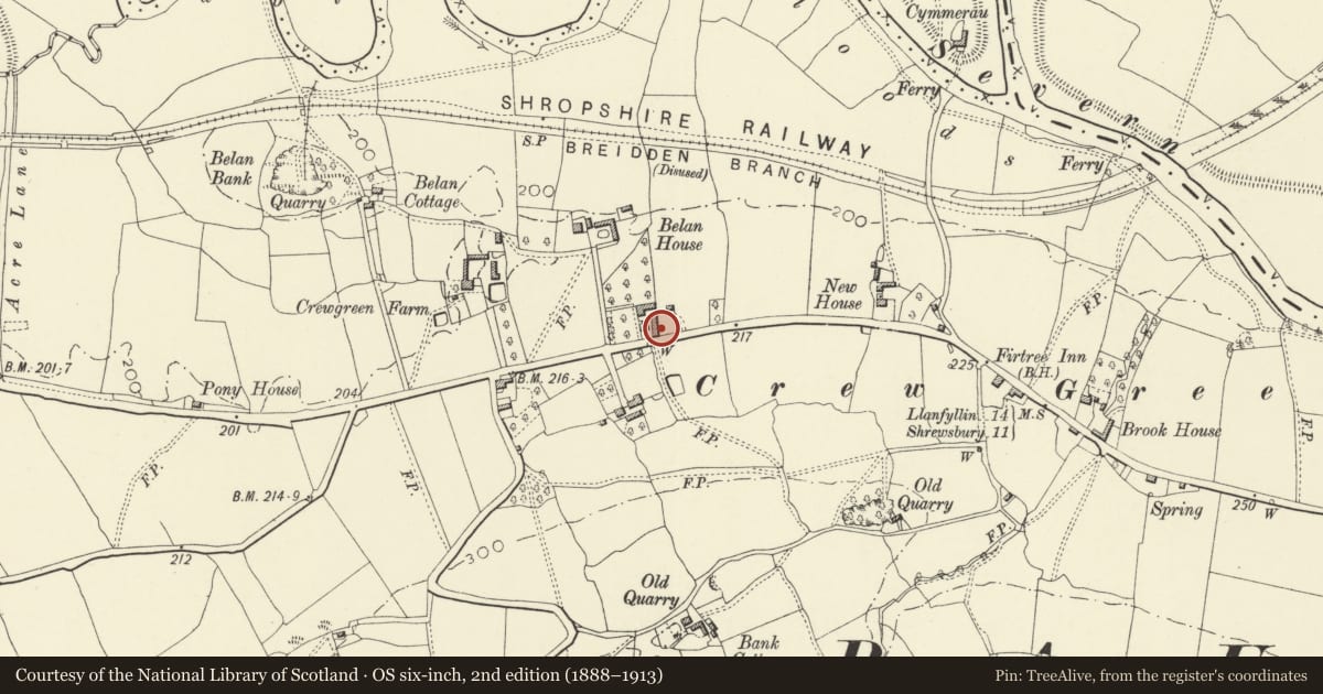
Slide toward Today to fade the historical sheet and see the modern map underneath.
David Rumsey Map Collection, Stanford LibrariesDavid Rumsey Map Collection, Stanford LibrariesDavid Rumsey Map Collection, Stanford LibrariesDavid Rumsey Map Collection, Stanford LibrariesDavid Rumsey Map Collection, Stanford Libraries
5 historical maps cover this location, the earliest the 1637 map "Particular description of Wales. Cambria seu Wallia" (David Rumsey Map Collection, Stanford Libraries).
Historical maps covering this location
- 1637 · Particular description of Wales. Cambria seu Wallia (David Rumsey Map Collection, Stanford Libraries)
- 1883 · Watershed map England, Wales 3. (David Rumsey Map Collection, Stanford Libraries)
- 1899 · 151 Welshpool (Hills) (David Rumsey Map Collection, Stanford Libraries)
- 1901 · Sheet 9 and 10. (David Rumsey Map Collection, Stanford Libraries)
- 1916 · Sheet 60. Shrewsbury. (David Rumsey Map Collection, Stanford Libraries)
Cadw's description
Location
Situated close to and at right angles to the road (B4393), and forming the E side of the farmyard.
History
Farm buildings. C19.
Exterior
Dolerite, but brick elevation on W side facing farmyard and slate roof. A 7-bay long multi-purpose range including cow house, barn and pigeon loft, the three S bays and the northern bay are floored, the last accessed by external brick steps. Double cart entrance to E reduced by brick to a single door. Pigeon loft in bays 2 and 3 from N has three tiers of 12 nest boxes with perching ledges. Brick front facing farmyard has two tiers of cruciform vents, and small square vents in stonework of rear stonework. Three boarded doors to farmyard and various openings.
Interior
Queen post trusses carrying collar notched for single tier of purlins.
Reason for designation
A conspicuous building in the centre of the hamlet, framing the approach to the working side of the farmhouse.
Nearby in the register
- The FirsDomesticunder 1 mi
- Manor Farmhouse (also known as Crew Green Farmhouse)Domesticunder 1 mi
- Bausley Hill CampHillfortunder 1 mi
- The HaimDomesticunder 1 mi
Other entries of the same register within about three miles of this one, by straight line.