Cof Cymru: National Historic Assets of Wales · Wales
The Haim
Llandrinio, Powys, Wales
A Grade II listed building in Haim, Llandrinio, Powys, designated on 29 December 1994.
The record
- Designation
- Listed building, Grade II
- Broad class
- Domestic
- Date of designation
- 29 December 1994
- Locality
- Haim
- Community
- Llandrinio
- Unitary authority
- Powys
- Country
- Wales
- Coordinates
- 52.74381, -2.99851
- Cadw reference
- 15426
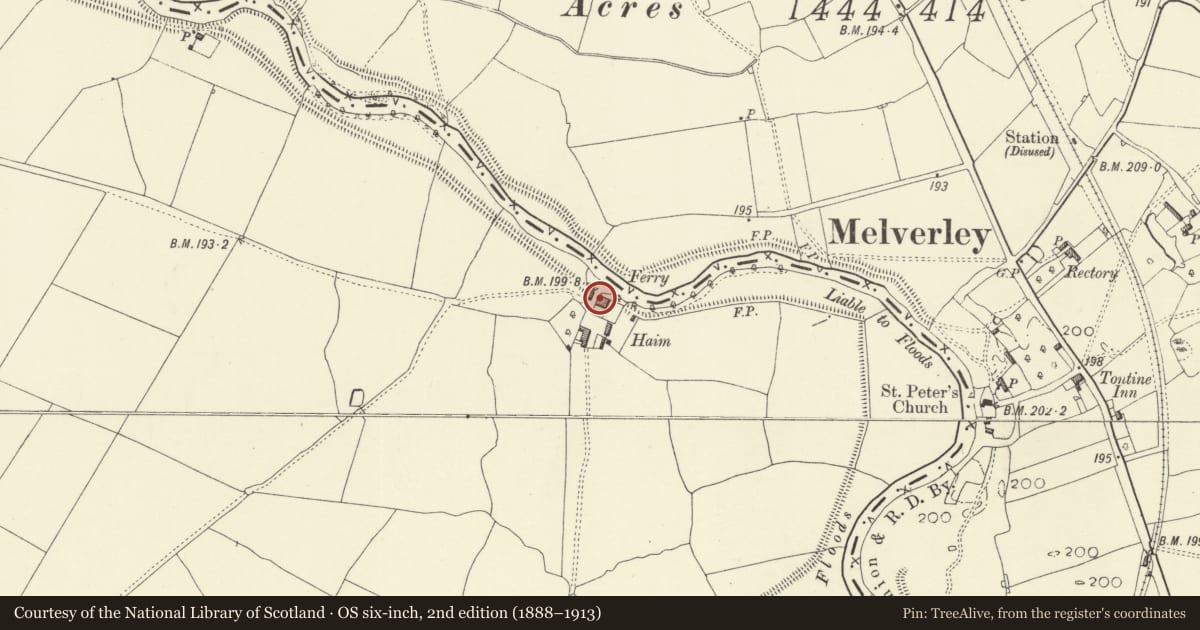
Slide toward Today to fade the historical sheet and see the modern map underneath.
David Rumsey Map Collection, Stanford LibrariesDavid Rumsey Map Collection, Stanford LibrariesDavid Rumsey Map Collection, Stanford LibrariesDavid Rumsey Map Collection, Stanford LibrariesDavid Rumsey Map Collection, Stanford Libraries
5 historical maps cover this location, the earliest the 1830 map "V.3:11-15:XV.Britisches Reich. A. Kon: England. a. England ab sich: Shire:15-17, 33" (David Rumsey Map Collection, Stanford Libraries).
Historical maps covering this location
- 1830 · V.3:11-15:XV.Britisches Reich. A. Kon: England. a. England ab sich: Shire:15-17, 33 (David Rumsey Map Collection, Stanford Libraries)
- 1883 · Watershed map England, Wales 3. (David Rumsey Map Collection, Stanford Libraries)
- 1899 · 151 Welshpool (Hills) (David Rumsey Map Collection, Stanford Libraries)
- 1901 · Sheet 9 and 10. (David Rumsey Map Collection, Stanford Libraries)
- 1916 · Sheet 60. Shrewsbury. (David Rumsey Map Collection, Stanford Libraries)
Cadw's description
Location
Located on a large area of alluvial land between the Rivers Severn and Vyrnwy.
History
The farm appears to be a primary settlement on marshland reclaimed by the construction of argua/argy (levees) by Thomas Telford, surveyor of public works for Shropshire, after the Commons Enclosure Act 1799, to protect the town of Shrewsbury from a series of disastrous floods.
Exterior
Farmhouse, early C19, brick with slate roofs. Two stories, 2 bays with 2-bay 3-storey wing at SE end with rear stack, now the main house area, further extended with a longer lean-to on the N side. Brick dentilled eaves to earlier section. Large canopied porch on columns over part-glazed door. Sixteen paned sash window to the earlier wing. C20 additions at rear.
Reason for designation
Included as a good example of regional farmhouse, which has historic interest also as part of the new settlement pattern after early C19 land reclamation.
Nearby in the register
- The FirsDomesticunder 1 mi
- Farm Building Range at the FirsAgriculture and Subsistenceunder 1 mi
- Manor Farmhouse (also known as Crew Green Farmhouse)Domesticunder 1 mi
- Criggion BridgeTransport1 mi
Other entries of the same register within about three miles of this one, by straight line.