Cof Cymru: National Historic Assets of Wales · Wales
Piggeries at Nerquis Hall
Nercwys, Flintshire, Wales
A Grade II listed building in Nerquis Hall Estate, Nercwys, Flintshire, designated on 12 December 1994.
The record
- Designation
- Listed building, Grade II
- Broad class
- Domestic
- Date of designation
- 12 December 1994
- Locality
- Nerquis Hall Estate
- Community
- Nercwys
- Unitary authority
- Flintshire
- Country
- Wales
- Coordinates
- 53.13195, -3.13531
- Cadw reference
- 15217
Slide toward Today to fade the historical sheet and see the modern map underneath.
David Rumsey Map Collection, Stanford LibrariesDavid Rumsey Map Collection, Stanford LibrariesDavid Rumsey Map Collection, Stanford LibrariesDavid Rumsey Map Collection, Stanford LibrariesLlyfrgell Genedlaethol Cymru – The National Library of Wales
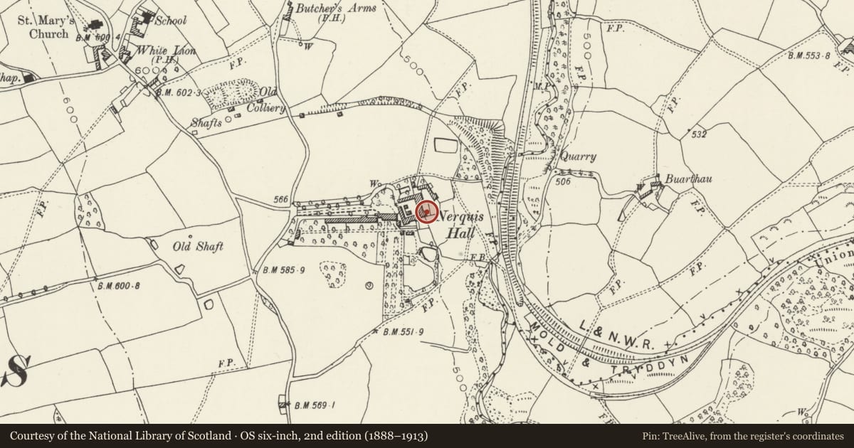
5 historical maps cover this location, the earliest the 1795 map "To Sir Watkin Williams-Wynn Bart ... the map of the six counties of North Wales is most humbly inscribed by his obedient humble servant" (Llyfrgell Genedlaethol Cymru – The National Library of Wales).
Historical maps covering this location
- 1795 · To Sir Watkin Williams-Wynn Bart ... the map of the six counties of North Wales is most… (Llyfrgell Genedlaethol Cymru – The National Library of Wales)
- 1883 · Watershed map England, Wales 3. (David Rumsey Map Collection, Stanford Libraries)
- 1898 · 108 Flint (Hills) (David Rumsey Map Collection, Stanford Libraries)
- 1898 · 108 Flint (Outline) (David Rumsey Map Collection, Stanford Libraries)
- 1901 · Sheet 9 and 10. (David Rumsey Map Collection, Stanford Libraries)
Cadw's description
Location
To the rear (E) of the barn and stable range and enclosing a cobbled yard to the N and E.
Exterior
Late C18 former coach-house and cart-house with adjacent piggeries to the N. Rubble with Sandstone ashlar facing, the coach and cart houses with slate roofs. The coach house section (to the L) is gabled with tile coping and plain kneelers. 2 large entrances with depressed- arched heads and chamfered reveals. Modern boarded double-doors. Stepped-down, and adjoining to the R, the former cartshed. 4 plain- arched openings with projecting keys to depressed heads, the outer ones now partly bricked-up. S gable end with later buttressing and rebuilt brick upper section. The rear pitch of the roof is of corrugated iron.
Adjoining the cart-house to the S is a contemporary open gateway. Rubble with rough-dressed stone quoins and capping (some lost). This opens into a walled enclosure which runs behind (to the E) the coach/cart range in a rough square and terminates in a modern gate in the NW corner. The wall is of rubble, with stone capping, stepped up at the NE corner, and partly collapsed to the N.
Adjoining the coach-house to the L and forming a rough L, a series of pig-sties. Depressed-arched entrances to a coped and stone-faced brick wall. Mono-pitched roof to rear (now mostly collapsed) serving brick sties.
Adjoining to the S a dwarf rubble wall, terminating at the junction with the NE corner of the stable range in a pair of plain stone gate-piers with conical capping. Plain
late C18 wrought iron gates still in situ.
Reason for designation
An interesting complex, being part of the 1790s additions by John Giffard.
Group value with the barn and stable range at Nerquis Hall.
Nearby in the register
- Barn at Nequis Hall EstateAgriculture and Subsistenceunder 1 mi
- Enclosing Walls to rear meadow at Nerquis HouseDomesticunder 1 mi
- Coach-House and Cart-House at Nerquis HallDomesticunder 1 mi
- Garage Block (former outbuilding) at Nerquis HallDomesticunder 1 mi
Other entries of the same register within about three miles of this one, by straight line.