Cof Cymru: National Historic Assets of Wales · Wales
Barn at Nequis Hall Estate
Nercwys, Flintshire, Wales
A Grade II* listed building in Nercwys, Flintshire, designated on 12 December 1994.
The record
- Designation
- Listed building, Grade II*
- Broad class
- Agriculture and Subsistence
- Date of designation
- 12 December 1994
- Locality
- Nercwys
- Community
- Nercwys
- Unitary authority
- Flintshire
- Country
- Wales
- Coordinates
- 53.13213, -3.13552
- Cadw reference
- 15214
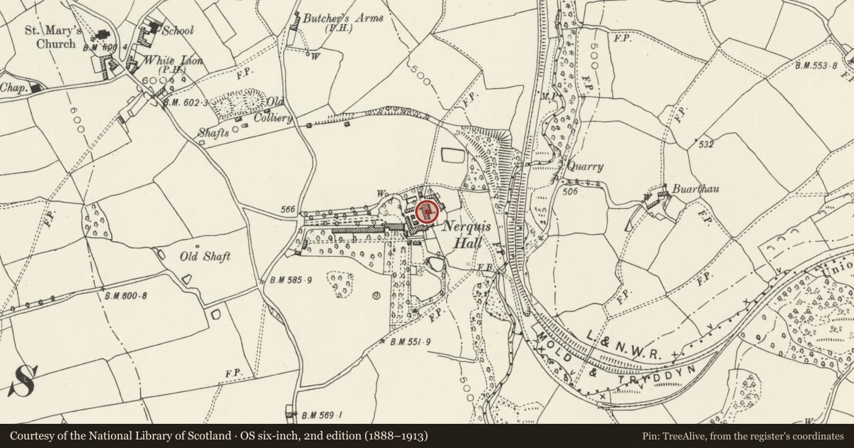
Slide toward Today to fade the historical sheet and see the modern map underneath.
David Rumsey Map Collection, Stanford LibrariesDavid Rumsey Map Collection, Stanford LibrariesDavid Rumsey Map Collection, Stanford LibrariesDavid Rumsey Map Collection, Stanford LibrariesLlyfrgell Genedlaethol Cymru – The National Library of Wales
5 historical maps cover this location, the earliest the 1795 map "To Sir Watkin Williams-Wynn Bart ... the map of the six counties of North Wales is most humbly inscribed by his obedient humble servant" (Llyfrgell Genedlaethol Cymru – The National Library of Wales).
Historical maps covering this location
- 1795 · To Sir Watkin Williams-Wynn Bart ... the map of the six counties of North Wales is most… (Llyfrgell Genedlaethol Cymru – The National Library of Wales)
- 1883 · Watershed map England, Wales 3. (David Rumsey Map Collection, Stanford Libraries)
- 1898 · 108 Flint (Hills) (David Rumsey Map Collection, Stanford Libraries)
- 1898 · 108 Flint (Outline) (David Rumsey Map Collection, Stanford Libraries)
- 1901 · Sheet 9 and 10. (David Rumsey Map Collection, Stanford Libraries)
Cadw's description
Location
Located at the E side of the service court.
Exterior
A exceptionally large rubble-built hay barn. C17, raised late C18. Shallow-pitched slate roof with coped gables and shaped kneelers. 3 tiers of ventilation slits with a further tier added at the time
of raising. At the same time the central entrance has been enlarged and given a wide, depressed-arched head. Flanking this, and above, 2 oculi with plain ashlar voussoirs. Brick cambered-headed entrance with boarded stable door to N gable with loading bay above.
Interior
7 bays with the original trusses still in situ, despite the raising. Queen post trusses with chamfered, trenched purlins.
Reason for designation
A fine and unusually large early barn with with good, yet restrained later work
Nearby in the register
- Stable/Office Range at Nerquis Hall EstateDomesticunder 1 mi
- Piggeries at Nerquis HallDomesticunder 1 mi
- Coach-House and Cart-House at Nerquis HallDomesticunder 1 mi
- Screen Walls at Nerquis Hall EstateDomesticunder 1 mi
Other entries of the same register within about three miles of this one, by straight line.