Cof Cymru: National Historic Assets of Wales · Wales
Church Hall of Church of St Deiniol
Hawarden, Flintshire, Wales
A Grade II listed building in Hawarden, Flintshire, designated on 16 November 1994.
The record
- Designation
- Listed building, Grade II
- Broad class
- Religious, Ritual and Funerary
- Date of designation
- 16 November 1994
- Community
- Hawarden
- Unitary authority
- Flintshire
- Country
- Wales
- Coordinates
- 53.18526, -3.02629
- Cadw reference
- 15021
Slide toward Today to fade the historical sheet and see the modern map underneath.
David Rumsey Map Collection, Stanford LibrariesDavid Rumsey Map Collection, Stanford LibrariesDavid Rumsey Map Collection, Stanford LibrariesDavid Rumsey Map Collection, Stanford LibrariesLlyfrgell Genedlaethol Cymru – The National Library of Wales
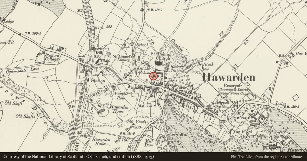
5 historical maps cover this location, the earliest the 1795 map "To Sir Watkin Williams-Wynn Bart ... the map of the six counties of North Wales is most humbly inscribed by his obedient humble servant" (Llyfrgell Genedlaethol Cymru – The National Library of Wales).
Historical maps covering this location
- 1795 · To Sir Watkin Williams-Wynn Bart ... the map of the six counties of North Wales is most… (Llyfrgell Genedlaethol Cymru – The National Library of Wales)
- 1883 · Watershed map England, Wales 3. (David Rumsey Map Collection, Stanford Libraries)
- 1898 · 108 Flint (Hills) (David Rumsey Map Collection, Stanford Libraries)
- 1898 · 108 Flint (Outline) (David Rumsey Map Collection, Stanford Libraries)
- 1901 · Sheet 9 and 10. (David Rumsey Map Collection, Stanford Libraries)
Cadw's description
Location
On the street line.
Exterior
A one and a half storey double-pile building in neo-Elizabethan style, built in 1875 and in use as the village infants school until 1975, where after the church hall. Of red brick, under a steeply-pitched slate roof. Twin gables facing the street, with simply moulded stone copings and central projecting kneelers. Paired, chamfered stone cross windows to each gable, with sloping cills. Entrance to N via a large porch with steep gable, canted out to accomodate shallow-roofed flanking bays. Plain modern entrance and doors. Blocked ogee-headed entrance to E face. Recessed, 6-pane sash windows flanking porch. Cambered heads. Slightly oversailing and dentilated upper gables, the main street-facing ones with central, single-light, 2-pane windows. Diaper decoration in blue headers to gables with similar decorative banding. Plain brick plinth. Simple chimney with necking to rear of L gable.
15021
References
Reason for designation
Listed for group value with the neighbouring Tithe Barn.
Nearby in the register
- White House (formerly School Mistresses House)Domesticunder 1 mi
- Tithe BarnEducationunder 1 mi
- Tithe Barn CottageEducationunder 1 mi
- Saint Deiniol's Parish Churchs Entrance Gates and Churchyard WallsDomesticunder 1 mi
Other entries of the same register within about three miles of this one, by straight line.