Cof Cymru: National Historic Assets of Wales · Wales
Saint Deiniol's Parish Churchs Entrance Gates and Churchyard Walls
Hawarden, Flintshire, Wales
A Grade II listed building in Hawarden, Flintshire, designated on 16 November 1994.
The record
- Designation
- Listed building, Grade II
- Broad class
- Domestic
- Date of designation
- 16 November 1994
- Community
- Hawarden
- Unitary authority
- Flintshire
- Country
- Wales
- Coordinates
- 53.18563, -3.02622
- Cadw reference
- 15020
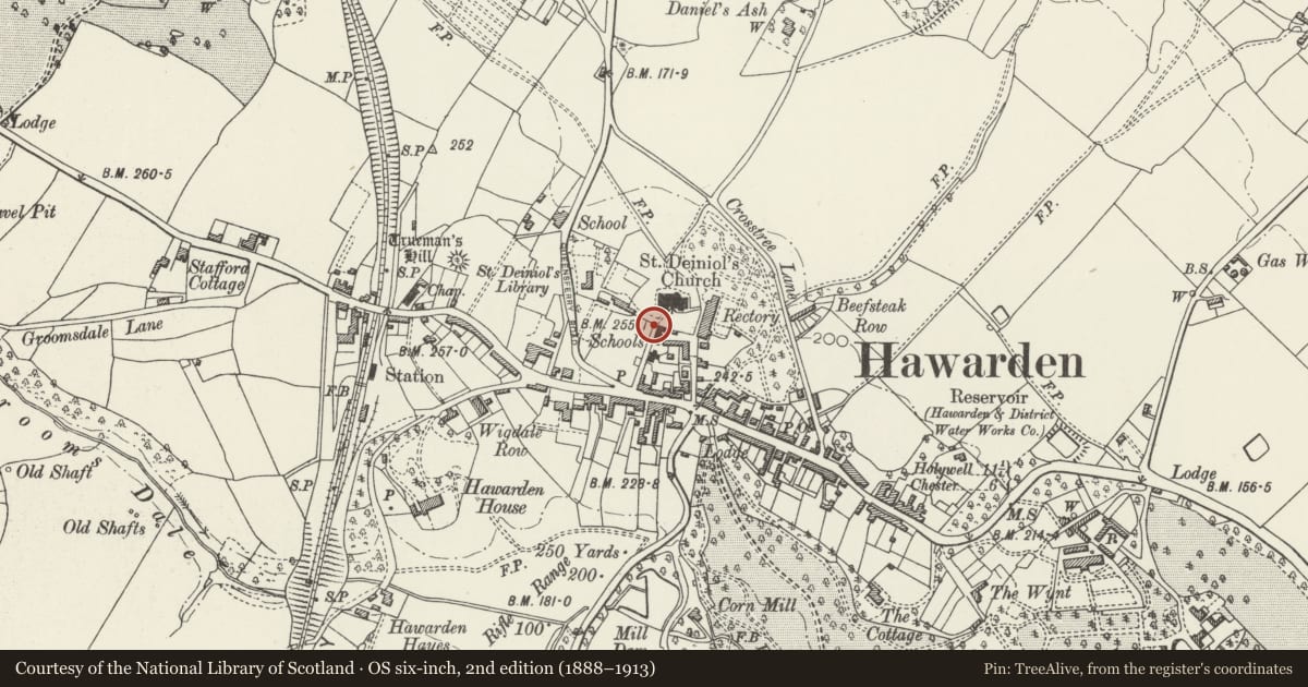
Slide toward Today to fade the historical sheet and see the modern map underneath.
David Rumsey Map Collection, Stanford LibrariesDavid Rumsey Map Collection, Stanford LibrariesDavid Rumsey Map Collection, Stanford LibrariesDavid Rumsey Map Collection, Stanford LibrariesLlyfrgell Genedlaethol Cymru – The National Library of Wales
5 historical maps cover this location, the earliest the 1795 map "To Sir Watkin Williams-Wynn Bart ... the map of the six counties of North Wales is most humbly inscribed by his obedient humble servant" (Llyfrgell Genedlaethol Cymru – The National Library of Wales).
Historical maps covering this location
- 1795 · To Sir Watkin Williams-Wynn Bart ... the map of the six counties of North Wales is most… (Llyfrgell Genedlaethol Cymru – The National Library of Wales)
- 1883 · Watershed map England, Wales 3. (David Rumsey Map Collection, Stanford Libraries)
- 1898 · 108 Flint (Hills) (David Rumsey Map Collection, Stanford Libraries)
- 1898 · 108 Flint (Outline) (David Rumsey Map Collection, Stanford Libraries)
- 1901 · Sheet 9 and 10. (David Rumsey Map Collection, Stanford Libraries)
Cadw's description
Location
At end of Church Lane, the walls bordering St. Dieniol's Library, Cross Tree Lane, and the Rectory gardens.
Exterior
Churchyard gates by John Douglas of Chester. Built in 1877 of red sandstone, buttressed and with gabled caps. Decorative ironwork gates. Adjoining and enclosing both upper and lower churchyards, an irregular uncoursed, capped sandstone perimeter wall with entrances from St. Deiniol's Library, Cross Tree Lane, and the former Rectory. Attached to wall in S/W corner, a single-storey gabled storehouse of rough-dressed, uncoursed sandstone. Tiled roof with plaque under gable dated 1906. Plain chamfered entrance and asymmetrical, single-light windows.
Reason for designation
Included for group value with St. Deiniol's Parish Church.
Nearby in the register
- Tithe BarnEducationunder 1 mi
- Tithe Barn CottageEducationunder 1 mi
- Parish Church of St DeinolReligious, Ritual and Funeraryunder 1 mi
- Church Hall of Church of St DeiniolReligious, Ritual and Funeraryunder 1 mi
Other entries of the same register within about three miles of this one, by straight line.