Cof Cymru: National Historic Assets of Wales · Wales
White House (formerly School Mistresses House)
Hawarden, Flintshire, Wales
A Grade II listed building in Hawarden, Flintshire, designated on 16 November 1994.
The record
- Designation
- Listed building, Grade II
- Broad class
- Domestic
- Date of designation
- 16 November 1994
- Community
- Hawarden
- Unitary authority
- Flintshire
- Country
- Wales
- Coordinates
- 53.18527, -3.02593
- Cadw reference
- 15022
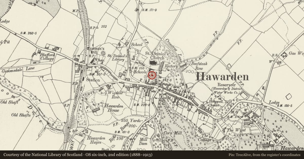
Slide toward Today to fade the historical sheet and see the modern map underneath.
David Rumsey Map Collection, Stanford LibrariesDavid Rumsey Map Collection, Stanford LibrariesDavid Rumsey Map Collection, Stanford LibrariesDavid Rumsey Map Collection, Stanford LibrariesLlyfrgell Genedlaethol Cymru – The National Library of Wales
5 historical maps cover this location, the earliest the 1795 map "To Sir Watkin Williams-Wynn Bart ... the map of the six counties of North Wales is most humbly inscribed by his obedient humble servant" (Llyfrgell Genedlaethol Cymru – The National Library of Wales).
Historical maps covering this location
- 1795 · To Sir Watkin Williams-Wynn Bart ... the map of the six counties of North Wales is most… (Llyfrgell Genedlaethol Cymru – The National Library of Wales)
- 1883 · Watershed map England, Wales 3. (David Rumsey Map Collection, Stanford Libraries)
- 1898 · 108 Flint (Hills) (David Rumsey Map Collection, Stanford Libraries)
- 1898 · 108 Flint (Outline) (David Rumsey Map Collection, Stanford Libraries)
- 1901 · Sheet 9 and 10. (David Rumsey Map Collection, Stanford Libraries)
Cadw's description
Location
Located behind St. Deinol's Church Hall, adjacent to its car park.
Exterior
A small, 2-storey detached house of 3 periods. C17(?) ground floor with thick sandstone-rubble walls, now skim-rendered. Early C19 brick first floor, heightened in late C19, again in brick. Plain central stack (relating to final period) with medium-pitch slate roof and plain eaves. Entrance to S gable face. Recessed early C19 vertically-panelled door with plain wooden surround. 2-light, 2 pane casement window above, with 4-pane sliding window to L on ground floor. Both near-flush with cambered heads. Evidence of previous entrance (now sliding window) to W face. Single-storey lean-to to E relating to late C19 remodelling. Slate roof with small rear chimney to E. Near-flush 4-pane casement window to S face. Modern glazing.
Reason for designation
Included for group value with the Tithe Barn and the church hall.
Nearby in the register
- Tithe Barn CottageEducationunder 1 mi
- 1 Rectory LaneDomesticunder 1 mi
- 2 Rectory LaneDomesticunder 1 mi
- 7 Rectory LaneDomesticunder 1 mi
Other entries of the same register within about three miles of this one, by straight line.