Cof Cymru: National Historic Assets of Wales · Wales
Entrance Gates Piers and Railings at Glanarberth
Llangoedmor, Ceredigion, Wales
A Grade II listed building in Llechryd, Llangoedmor, Ceredigion, designated on 10 August 1994.
The record
- Designation
- Listed building, Grade II
- Broad class
- Domestic
- Date of designation
- 10 August 1994
- Locality
- Llechryd
- Community
- Llangoedmor
- Unitary authority
- Ceredigion
- Country
- Wales
- Coordinates
- 52.06318, -4.59910
- Cadw reference
- 14785
Slide toward Today to fade the historical sheet and see the modern map underneath.
David Rumsey Map Collection, Stanford LibrariesDavid Rumsey Map Collection, Stanford LibrariesDavid Rumsey Map Collection, Stanford LibrariesDavid Rumsey Map Collection, Stanford LibrariesDavid Rumsey Map Collection, Stanford Libraries
5 historical maps cover this location, the earliest the 1608 map "(13) Cambriae Typus." (David Rumsey Map Collection, Stanford Libraries).
Historical maps covering this location
- 1608 · (13) Cambriae Typus. (David Rumsey Map Collection, Stanford Libraries)
- 1636 · Cornubia : Devonia, Somersetus, Dorcestria, Wiltonia, Glocestria ... (David Rumsey Map Collection, Stanford Libraries)
- 1637 · Particular description of Wales. Cambria seu Wallia (David Rumsey Map Collection, Stanford Libraries)
- 1830 · V.3:11-15:XV. Britisches Reich. A. Kon: England. b. Frstenthum Wales: Shire: 37-40 (David Rumsey Map Collection, Stanford Libraries)
- 1899 · 194 Llangranog (Hills) (David Rumsey Map Collection, Stanford Libraries)
Cadw's description
Location
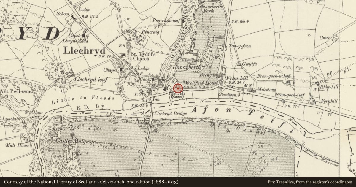
Situated some 200m E of Llechryd Bridge, at foot of entrance drive to demolished Glanarberth Mansion. Glanarberth was built in the 1860s and finally demolished 1986.
Exterior
Mid C19 entrance gates to Glanarberth. Two Cilgerran stone rusticated gatepiers with pyramid caps and concave curved low rusticated stone walls to similar outer piers. Wall has slate coping and spearhead iron rails. Centre pair of iron gates with spearhead rails, diagonally crossed strengthening bars and dog-bars.
Reason for designation
Included for grouping with other listed items in former Glanarberth estate.
Nearby in the register
- Llechryd Bridge (partly in Manordeifi community, Pembrokeshire)Transportunder 1 mi
- Llechryd BridgeBridgeunder 1 mi
- DerwyddDomesticunder 1 mi
- Gatepiers and Gates to E of Stable Cottage GlanarberthDomesticunder 1 mi
Other entries of the same register within about three miles of this one, by straight line.